AKA: none
Other ID: T-M2-09-AR
Status: Completed
Organization(s): USGS, Pacific Coastal and Marine Science Center
Funding Program(s): Arctic bluff retreat (MU012)
Principal Investigator(s): Li Erikson, Curt Storlazzi
Affiliate Investigator(s):
Information Specialist(s): Li Erikson
Data Type(s): Sampling: Geology, Location-Elevation: Navigation, Environmental Data: Current, Environmental Data: Wave, Imagery: Photo, Time Series: Mooring (physical oceanography)
Scientific Purpose/Goals: To obtain baseline measurements and support research contributing to the development of a predictive model of Arctic bluff retreat and inundation of barrier islands due to the a changing global climate on the North Slope of Alaska.
Vehicle(s):
Start Port/Location: Barrow, Alaska
End Port/Location: Barrow, Alaska
Start Date: 2009-09-30
End Date: 2009-10-05
Equipment Used: grab sampler, RTK GPS, Nortek AWAC, camera, tripod
Information to be Derived: Beach Topography, bluff edge position, sediment grain size
Summary of Activity and Data Gathered: Recovery of bottom-mounted instruments from TM109AR, beach topography, and sediment sampling. Used bed sediment camera for sediment grain size measurements.
Staff: Li Erikson, Thomas Reiss, Curt Storlazzi
Affiliate Staff:
Robert Shears (Olgoonik Oil Corp.) - Vessel captain
Blair Patkotak
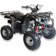
Notes: mooring AIN09F1T. Shop time includes the design and construction of bottom mounts specifically designed for the North Slope. Deployment of Trawl Resistant Bottom Mount deployed Aug. 10-25. Platforms used: Two vessels, ATVs, and by foot.
Staff information imported from InfoBank
Li Erikson
Curt Storlazzi
Tom Reiss
Robert Shears (Olgoonik Oil Corp.) - Vessel captain
Blair Patkotak
Location:
Alaska
| Boundaries | |||
|---|---|---|---|
| North: 70.67055 | South: 70.63164 | West: -160.055 | East: -159.96637 |
Platform(s):
 ATV |  Boat |  on foot |
Erikson, L.H., Storlazzi, C.D., Collins, B.D., Hatcher, G.A., Reiss, T.E., and Engelstad, A.C., 2022, Hydrographic and sediment field data collected in the vicinity of Wainwright, Alaska, in 2009: U.S. Geological Survey data release, https://doi.org/10.5066/P94V9W0S.
| Survey Equipment | Survey Info | Data Type(s) | Data Collected |
|---|---|---|---|
| grab sampler | --- | Surveys (geochemical) Geology | Grain-size data from samples collected in 2009 at three bluff locations in the vicinity of Wainwright, Alaska (Grain-size data, including grain size, cumulative frequency, and median, was determined from samples collected at three bluff locations in the vicinity of Wainwright, Alaska. The different locations (termed W1, W2, and W3) represent three different slope-failure modes. Sediment grab samples for most bluff locations were collected in August 2009, while sediment samples from the bluff at site W3 and multiple foreshore locations were collected in September and October of 2009. Two of the grab samples were sieved and analyzed for grain size distributions (7 classes ranging from 0.06 to 0.72 mm). The grain size distribution of the remaining samples was determined from referenced photographs of collected samples taken in the lab following the method of Barnard and others (2007) using two-dimensional spectral decomposition of sediment images (Buscombe and others, 2010). Results of sieved samples were used to verify mean grain-size values obtained with the image processing algorithm. Data are available in a single csv file.) |
| RTK GPS | --- | LIDAR Transects Benchmarks Profiles Navigation | Elevation data (Beach and foreshore elevation data were collected in the vicinity of Wainwright, Alaska. The area from the mouth of the Kuk River to about 8 km to the northeast was measured in August 2009. The area from the mouth of the Kuk River to about 5 km to the northeast was measured in October 2009. The elevation data were collected with Real-Time Kinematic (RTK) Global Positioning System (GPS) systems mounted on all-terrain vehicles. The GPS sampling rate was 1 Hz with vehicle speeds maintained at less than 15 km/hour, resulting in a sample point resolution of 3-5 m. Data are available in a single csv file.) |
| Nortek AWAC | --- | Wave Current | |
| camera | --- | Photo | |
| tripod | --- | Mooring (physical oceanography) | Conductivity, temperature, depth, salinity, dissolved oxygen, nitrogen, and fluorescence data collected in 2009 in the vicinity of Wainwright, Alaska (Measurements of conductivity, temperature, and depth (CTD), in addition to dissolved oxygen, nitrogen, and fluorescence, were collected in the Wainwright Inlet, the mouth of the Kuk River, and in the nearshore region off Wainwright, Alaska, in August 2009 with a Seabird SBE 19. Post-survey calculations of salinity were made from the conductivity measurements.) |