AKA: none
Other ID: V-1-06-MB,MC_CHIRP
Status: Completed
Organization(s): USGS, Pacific Coastal and Marine Science Center
Funding Program(s): Monterey Canyon Head Multibeam, Chirp Subbottom (MU186)
Principal Investigator(s): Jingping Xu
Affiliate Investigator(s):
Information Specialist(s): Kurt Rosenberger
Data Type(s): Location-Elevation: Navigation, Seismics: Sub Bottom Profiler
Scientific Purpose/Goals: Map and profile sand waves in the Canyon Head
Vehicle(s):
Start Port/Location: Moss Landing, CA
End Port/Location: Moss Landing, CA
Start Date: 2006-02-21
End Date: 2006-02-25
Equipment Used: navigation, seismic
Information to be Derived: Bathymetry and Subbottom
Summary of Activity and Data Gathered: Two days of multibeam and two days of subbottom were acquired by the Seafloor Mapping Lab of Cal State Monterey Bay. Personnel:Rick Kvitek, Pat Iampietro, M. Young, D. Minard. No USGS Personnel on board during acquisition.
Staff:
Affiliate Staff:
Rick Kvitek - Cal. State Monterey Bay
Pat Iampietro - Cal. State Monterey Bay
M. Young - Cal. State Monterey Bay
D. Minard - Cal. State Monterey Bay
Notes:
Staff information imported from InfoBank
Rick Kvitek - Cal. State Monterey Bay
Pat Iampietro - Cal. State Monterey Bay
M. Young - Cal. State Monterey Bay
D. Minard - Cal. State Monterey Bay
Location:
Monterey Submarine Canyon
| Boundaries | |||
|---|---|---|---|
| North: 37 | South: 36.75 | West: -122.5 | East: -121.75 |
Platform(s):
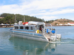 VenTresca |
| Survey Equipment | Survey Info | Data Type(s) | Data Collected |
|---|---|---|---|
| navigation | --- | Navigation | Best file with nav in ArcInfo E00 format Global positioning system (GPS) data v-1-06-mb.060 (Provisional best file) |
| seismic | --- | Sub Bottom Profiler |
