AKA: none
Other ID: V-1-68-SC
Status: Completed
Organization(s):
Funding Program(s):
Principal Investigator(s): Jack Vedder
Affiliate Investigator(s):
Information Specialist(s):
Data Type(s): Sampling: Geology
Scientific Purpose/Goals:
Vehicle(s):
Start Port/Location:
End Port/Location:
Start Date: 1968-01-01
End Date: 1968-01-01
Equipment Used: dartcore, dredge
Information to be Derived:
Summary of Activity and Data Gathered:
Staff:
Affiliate Staff:
Notes:
Staff information imported from InfoBank
Jack Vedder (USGS Western Region) - Chief Scientist
Location:
Southern California
| Boundaries | |||
|---|---|---|---|
| North: 33.98 | South: 32.01833 | West: -119.0083 | East: -117.80833 |
Platform(s):
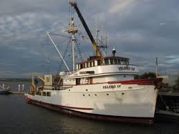 Velero |
Vedder, J.G., Beyer, L.A., Junger, A., Moore, G.W., Roberts, A.E., Taylor, J.C., and Wagner, H.C., 1974, Preliminary report on the geology of the continental borderland of Southern California: U. S. Geological Survey Miscellaneous Field Studies Map 624, 34 p., https://doi.org/10.3133/mf624.
| Survey Equipment | Survey Info | Data Type(s) | Data Collected |
|---|---|---|---|
| dartcore | --- | Geology | Station Information |
| dredge | --- | Geology | Station Information |
