AKA: none
Other ID: V-1-75-SC,SCAL-75-KD
Status: Completed
Organization(s):
Funding Program(s):
Principal Investigator(s): Sam Clarke
Affiliate Investigator(s):
Information Specialist(s): Terry Hallinan
Data Type(s): Location-Elevation: Navigation, Sampling: Biology, Sampling: Geology, Seismics: Boomer, Sonar: Single Beam
Scientific Purpose/Goals: To conduct detailed geophysical and geological studies in the Tanner and Cortes Banks area, southern California borderland.
Vehicle(s):
Start Port/Location: Wilmington, CA
End Port/Location: Wilmington, CA
Start Date: 1975-05-21
End Date: 1975-06-09
Equipment Used: gravitycore, dartcore, Phlegercore, VanVeengrab, Campbellgrab, Ponargrab, deadreckoning, chaindredge, uniboom, Fathometer, boxcore
Information to be Derived:
Summary of Activity and Data Gathered: physical data holdings
Staff: Bob Arnal, Gary Greene, Terry Hallinan, Jim Joyce, Bob Patrick, Paula Quinterno, Bob Rowland
Affiliate Staff:
Mike Crawford (USC) - Watchstander
A. Buchanan (NSI) - Navigator
Steve Jessup (NSI) - Navigator
L. Pierce (NSI) - Navigator
Ed Welday (SCA) - Observer
Patrick Day (SCA) - Watchstander
Andy Valois (USC) - Ship's Captain
Richard Powell (USC) - First Mate
Edward Reyes (USC) - Chief Engineer
D. Warren
D. Newman
Notes: Staff information imported from InfoBank
Sam Clarke (USGS Western Region) - Chief Scientist
Terry Hallinan (USGS Western Region) - Dafe Curator
Gary Greene (USGS Western Region) - Geologist
Bob Rowland (USGS Western Region) - Geologist
Paula Quinterno (USGS Western Region) - Geologist
Mike Crawford (USC) - Watchstander
Robert Patrick (USGS Western Region) - Electrician
A. Buchanan (NSI) - Navigator
Steve Jessup (NSI) - Navigator
L. Pierce (NSI) - Navigator
Jim Joyce - Watchstander
Bob Arnal - Geologist
Ed Welday (SCA) - Observer
Patrick Day (SCA) - Watchstander
Andy Valois (USC) - Ship's Captain
Richard Powell (USC) - First Mate
Edward Reyes (USC) - Chief Engineer
D. Warren
D. Newman
Location:
Southern California
| Boundaries | |||
|---|---|---|---|
| North: 33.30163 | South: 32.31782 | West: -119.452 | East: -118.8712 |
Platform(s):
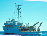 Velero IV |
| Survey Equipment | Survey Info | Data Type(s) | Data Collected |
|---|---|---|---|
| gravitycore | --- | Geology | |
| dartcore | --- | Geology | Station Information |
| Phlegercore | --- | Geology | |
| VanVeengrab | --- | Geology | |
| Campbellgrab | --- | Geology | |
| Ponargrab | --- | Geology | |
| deadreckoning | --- | Navigation | Best file with nav in ArcInfo E00 format Dead reckoning data v-1-75-sc.010 (Provisional best file) Dead reckoning data v-1-75-sc.010_degree |
| chaindredge | --- | Geology | |
| uniboom | --- | Boomer | |
| Fathometer | --- | Single Beam | |
| boxcore | --- | Chemistry Biology Geology |
