AKA: none
Other ID: V-1-81-SC
Status: Completed
Organization(s):
Funding Program(s):
Principal Investigator(s): Brian Edwards, Michael Field
Affiliate Investigator(s):
Information Specialist(s):
Data Type(s): Imagery: Photo, Location-Elevation: Navigation, Sampling: Geology, Seismics: Boomer, Seismics: Sparker, Seismics: Sub Bottom Profiler, Sonar: Sidescan
Scientific Purpose/Goals:
Vehicle(s):
Start Port/Location: Wilmington, CA
End Port/Location: Wilmington, CA
Start Date: 1981-08-24
End Date: 1981-08-30
Equipment Used: 3.5khz, RhoRho, miniranger, radar, transitsatellite, uniboom, sidescansonar, gravitycore, underwatercamera, minisparker
Information to be Derived:
Summary of Activity and Data Gathered: physical data holdings
Staff: Russell Crane, Jim Gardner, Bob Hall, Carol Hirozawa, Larry Kooker, Carol Madison, Kevin O'Toole
Affiliate Staff:
Andy Valois - Ship Captain
Anne Jennings - Geologist
Tim Vogel - Geochemist
Whitey Platt - Chief Mate
Notes: Staff information imported from InfoBank
Andy Valois - Ship Captain
Anne Jennings - Geologist
Bob Hall - Geologist
Brian Edwards (USGS Western Region) - Chief Scientist
Carol Hirozawa (USGS Western Region) - Navigator
Carol Madison (USGS Western Region) - Navigator
Jim Gardner (USGS Western Region) - Geologist
Kevin O'Toole (USGS Western Region) - Mechanical Technician
Larry Kooker (USGS Western Region) - Electronics Technician
Mike Field (USGS Western Region) - Chief Scientist
Russell Crane - Geologist
Tim Vogel - Geochemist
Whitey Platt - Chief Mate
Location:
Southern California
| Boundaries | |||
|---|---|---|---|
| North: 34.40625 | South: 33.20033 | West: -120.5252 | East: -118.38283 |
Platform(s):
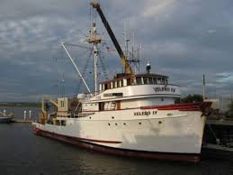 Velero |
Steele, W.C., Degnan, C.H., Deeter, G.B., and Riordan, J.A., 1989, Description of marine geophysical data collected by the U.S. Geological Survey and how to obtain it: U.S. Geological Survey Open-File Report 89-167, 26 p., https://pubs.er.usgs.gov/publication/ofr89167.
| Survey Equipment | Survey Info | Data Type(s) | Data Collected |
|---|---|---|---|
| 3.5khz | --- | Sub Bottom Profiler | Edited bathymetry data v-1-81-sc.335_052 (Provisional best file) Edited bathymetry data v-1-81-sc.335 Metadata NGDC MGD77 data - bathy |
| RhoRho | --- | Navigation | Metadata |
| miniranger | --- | Navigation | Raw Miniranger data v-1-81-sc.622 Miniranger Operations Table v-1-81-sc.632 Miniranger Land Table in Lat/Long v-1-81-sc.641 Lines Metadata |
| radar | --- | Navigation | Metadata |
| transitsatellite | --- | Navigation | Best file with nav in ArcInfo E00 format Integrated navigation (SINS) data v-1-81-sc.052 (Provisional best file) Integrated navigation (SINS) data v-1-81-sc.052_degree Metadata |
| uniboom | --- | Boomer | |
| sidescansonar | --- | Sidescan | |
| gravitycore | --- | Geology | Subsample Request Station Information |
| underwatercamera | --- | Photo | |
| minisparker | --- | Sparker |
