AKA: none
Other ID: V-2-04-NC
Status: Completed
Organization(s): California State University Monterey Bay
Funding Program(s):
Principal Investigator(s): Patrick Barnard
Affiliate Investigator(s):
Information Specialist(s): Patrick Barnard
Data Type(s): Location-Elevation: Navigation, Sonar: Multibeam
Scientific Purpose/Goals:
Vehicle(s):
Start Port/Location:
End Port/Location:
Start Date: 2004-09-01
End Date: 2004-11-01
Equipment Used: navigation, Swath
Information to be Derived: swath bathymetry map provided under contract
Summary of Activity and Data Gathered:
Staff:
Affiliate Staff:
Notes:
Location:
Ocean Beach,California
| Boundaries | |||
|---|---|---|---|
| North: 38.25 | South: 36.25 | West: -123.75 | East: -121.75 |
Platform(s):
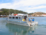 VenTresca |
Barnard, P.L., Erikson, L.H., Hansen, J.E., and Elias, Edwin, 2009, The performance of nearshore dredge disposal at Ocean Beach, San Francisco, California, 2005-2007: U.S. Geological Survey Open-File Report 2008-1347, 93 p., http://pubs.usgs.gov/of/2008/1347/.
| Survey Equipment | Survey Info | Data Type(s) | Data Collected |
|---|---|---|---|
| navigation | --- | Navigation | |
| Swath | --- | Multibeam |
