AKA: V3404Cruise_V34,_Leg_04
Other ID: none
Status: Completed
Organization(s): USGS, Pacific Coastal and Marine Science Center
Funding Program(s):
Principal Investigator(s):
Affiliate Investigator(s): W. Pitman
Information Specialist(s):
Data Type(s): Electro-Magnetic: Gravity, Electro-Magnetic: Magnetics, Location-Elevation: Navigation, Sampling: Geology, Seismics: Sub Bottom Profiler, Sonar: Single Beam
Scientific Purpose/Goals:
Vehicle(s):
Start Port/Location:
End Port/Location:
Start Date: 1977-05-28
End Date: 1977-06-23
Equipment Used: magnetometer, gravity, transit satellite, gravitycore, pistoncore, 3.5khz, 12khz
Information to be Derived:
Summary of Activity and Data Gathered:
Staff:
Affiliate Staff:
Notes:
Location:
Western Pacific
| Boundaries | |||
|---|---|---|---|
| North: 20.79720143 | South: -13.64347193 | West: 109.98 | East: 132.5585906 |
Platform(s):
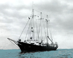 Vema |
| Survey Equipment | Survey Info | Data Type(s) | Data Collected |
|---|---|---|---|
| magnetometer | --- | Magnetics | Edited magnetics data v-4-77-wp.221_050 (provisional best file) |
| gravity | --- | Gravity | Free Air Anomaly data v-4-77-wp.160_050 (provisional best nav) |
| transit satellite | --- | Navigation | Integrated navigation (SINS) data v-4-77-wp.050 (provisional best) |
| gravitycore | --- | Geology | gravitycore (locations) |
| pistoncore | --- | Geology | pistoncore (locations) |
| 3.5khz | --- | Sub Bottom Profiler | Edited bathymetry data with corrected depths v-4-77-wp.320_050 (provisional best, nav) |
| 12khz | --- | Single Beam |
