AKA: none
Other ID: V-7B-66-NA,V2307
Status: Completed
Organization(s):
Funding Program(s):
Principal Investigator(s): J. Ewing
Affiliate Investigator(s):
Information Specialist(s):
Data Type(s): Time Series: Mooring (physical oceanography)
Scientific Purpose/Goals:
Vehicle(s):
Start Port/Location:
End Port/Location:
Start Date: 1966-12-08
End Date: 1966-12-15
Equipment Used: meters
Information to be Derived:
Summary of Activity and Data Gathered:
Staff:
Affiliate Staff:
Notes: Lamont-Doherty
Staff information imported from InfoBank
J. Ewing (Lamont, Doherty) - Chief Scientist
Location:
New York
| Boundaries | |||
|---|---|---|---|
| North: 42.25 | South: 25.25 | West: -82.75 | East: -50.25 |
Platform(s):
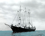 Vema |
| Survey Equipment | Survey Info | Data Type(s) | Data Collected |
|---|---|---|---|
| meters | --- | Mooring (physical oceanography) |
