AKA: none
Other ID: w-1-70-WO,7-Tow
Status: Completed
Organization(s):
Funding Program(s): Seven Tow (MU265)
Principal Investigator(s): Bill Normark
Affiliate Investigator(s):
Information Specialist(s):
Data Type(s): Seismics: Sub Bottom Profiler
Scientific Purpose/Goals:
Vehicle(s):
Start Port/Location:
End Port/Location:
Start Date: 1970-08-24
End Date: 1970-08-25
Equipment Used: seismic
Information to be Derived:
Summary of Activity and Data Gathered:
Staff:
Affiliate Staff:
Notes:
Staff information imported from InfoBank
Bill Normark (USGS Western Region) - Chief Scientist
Location:
Washington-Oregon
| Boundaries | |||
|---|---|---|---|
| North: 50 | South: 41 | West: -131.25 | East: -122.25 |
Platform(s):
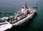 Thomas Washington |
| Survey Equipment | Survey Info | Data Type(s) | Data Collected |
|---|---|---|---|
| seismic | --- | Sub Bottom Profiler |
