AKA: none
Other ID: W-1-97-NC
Status: Completed
Organization(s):
Funding Program(s): Internal Waves over the Upper Continental Slope off Northern California (MU150)
Principal Investigator(s): George Tate
Affiliate Investigator(s):
Information Specialist(s): Joanne Thede
Data Type(s): Time Series: Mooring (physical oceanography), Environmental Data: Temperature, Environmental Data: Current, Environmental Data: Conductivity, Environmental Data: Turbidity, Sampling: Geology
Scientific Purpose/Goals: To measure the internal wave field on the upper continental slope over long time duration (> 1 year), and to estimate the effects of internal waves on the transport of sediment over the slope.
Vehicle(s):
Start Port/Location: Newport, OR
End Port/Location: Newport, OR
Start Date: 1997-01-22
End Date: 1997-01-22
Equipment Used: instrumentmooring, temperature, currentmeter, tempsalinometer, transmissometer, sedimenttrap
Information to be Derived: Seasonal changes in the internal temperature field over the slope, with analysis of the internal waves in this region.
Summary of Activity and Data Gathered: Time-series measurements (hourly) of temperature at 12 depths, currents and light transmission at three depths for over one year. This mooring was in 450m water depth; USGS had 11 temperature sensors at 150m, 200m, 250m, 300m, 320m, 340m, 360m, 380m, 400m, 420m, and 437m; University of Washington had current meters, conductivity gauges, temperature sensors, and light transmission meters on the mooring at 60m, 180m, and 435m; and SUNY had sediment traps on the mooring.
Staff:
Affiliate Staff:
Notes: Mooring recovery from P796NC (which was deployed on 7/22/96), instrumen t servicing/replacement, and mooring redeployment
Staff information imported from InfoBank
George Tate (USGS Western Region) - Chief Scientist
Location:
Northern California
| Boundaries | |||
|---|---|---|---|
| North: 42.75 | South: 36.25 | West: -125.75 | East: -116.25 |
Platform(s):
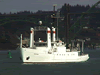 Wecoma |
| Survey Equipment | Survey Info | Data Type(s) | Data Collected |
|---|---|---|---|
| instrumentmooring | --- | Geology Mooring (physical oceanography) | |
| temperature | --- | Temperature | |
| currentmeter | --- | Current | |
| tempsalinometer | --- | Conductivity Temperature | |
| transmissometer | --- | Turbidity | |
| sedimenttrap | --- | Geology |
