AKA: none
Other ID: W-2-98-NC,W9807A
Status: Completed
Organization(s):
Funding Program(s): Strata Formations on Margins (Strataform) (MU278)
Principal Investigator(s): Homa Lee
Affiliate Investigator(s):
Information Specialist(s): Diane Minasian
Data Type(s): Environmental Data: CTD, Environmental Data: Depth, Location-Elevation: Navigation, Sampling: Biology, Sampling: Geology
Scientific Purpose/Goals:
Vehicle(s):
Start Port/Location:
End Port/Location:
Start Date: 1998-07-17
End Date: 1998-07-24
Equipment Used: CTD, Lehighcore, boxcore, piezometer, GPS
Information to be Derived:
Summary of Activity and Data Gathered:
Staff: Clark Alexander, Dan Arnsdorf, Bob Ashley, Mark Bachand, Bradley Carkin, Gita Dunhill, Timothy Elfers, Hal Williams
Affiliate Staff:
Don Michaelson (OSU) - Electronics Tech
Jacques Locat (Laval Univ Quebec) - Watchstsnder
Eric Boulanger (Laval Univ Quebec) - Watchstander
Harold Christian (GSC) - Watchstander
Francis Martin (Laval Univ Quebec) - Watchstander
Priscilla Desgagnes (Laval Univ Quebec) - Watchstander
Brian McAdoo (Vasser College) - Watchstander
Alyson Craig (WHOI) - Watchstander
Notes:
Staff information imported from InfoBank
Homa Lee (USGS Western Region) - Chief Scientist
Gita Dunhill (USGS Western Region) - Facs
Don Michaelson (OSU) - Electronics Tech
Hal Williams (USGS Western Region) - Mechanical Tech
Jacques Locat (Laval Univ Quebec) - Watchstsnder
Eric Boulanger (Laval Univ Quebec) - Watchstander
Harold Christian (GSC) - Watchstander
Brad Carkin (USGS Western Region) - Watchstander
Francis Martin (Laval Univ Quebec) - Watchstander
Priscilla Desgagnes (Laval Univ Quebec) - Watchstander
Brian McAdoo (Vasser College) - Watchstander
Clark Alexander (Skidway Inst of Oceanography) - Watchstander
Alyson Craig (WHOI) - Watchstander
Tim Elfers (USGS Western Region) - Watchstander
Dan Arnsdorf - Captain
Bob Ashley - Chief Engineer
Mark Bachand - Chief Mate
Location:
California
| Boundaries | |||
|---|---|---|---|
| North: 41.2375 | South: 40.0605 | West: -125.262 | East: -124.18683 |
Platform(s):
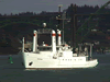 Wecoma |
Minasian, D.L., Lee, H.J., Locat, J., Orzech, K.M., Martz, G.R., and Israel, K., 2001, The STRATAFORM Project: geotechnical studies: U.S. Geological Survey Open-File Report 01-190, http://pubs.usgs.gov/of/2001/0190/.
| Survey Equipment | Survey Info | Data Type(s) | Data Collected |
|---|---|---|---|
| CTD | --- | Surveys (geochemical) Experiments (geochemical) CTD | Station Information |
| Lehighcore | --- | Geology | Station Information |
| boxcore | --- | Biology Geology | Station Information |
| piezometer | --- | Depth | Station Information |
| GPS | --- | Navigation | Best file with nav in ArcInfo E00 format Global positioning system (GPS) data w-2-98-nc.060 (Provisional best file) |
