AKA: none
Other ID: W-6-81-NC,CODE_1-2
Status: Completed
Organization(s):
Funding Program(s):
Principal Investigator(s): Dave Cacchione
Affiliate Investigator(s):
Information Specialist(s):
Data Type(s): Environmental Data: CTD, Location-Elevation: Navigation, Sampling: Biology, Sampling: Geology, Sonar: Sidescan, Sonar: Single Beam
Scientific Purpose/Goals:
Vehicle(s):
Start Port/Location:
End Port/Location:
Start Date: 1981-06-09
End Date: 1981-06-13
Equipment Used: sidescansonar, bathymetry, CTD, navigation, boxcore
Information to be Derived:
Summary of Activity and Data Gathered:
Staff:
Affiliate Staff:
Notes:
Staff information imported from InfoBank
Dave Cacchione (USGS Western Region) - Chief Scientist
Location:
Northern California
| Boundaries | |||
|---|---|---|---|
| North: 38.6585 | South: 38.63183 | West: -123.424 | East: -123.4085 |
Platform(s):
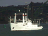 Wecoma |
| Survey Equipment | Survey Info | Data Type(s) | Data Collected |
|---|---|---|---|
| sidescansonar | --- | Sidescan | |
| bathymetry | --- | Single Beam | |
| CTD | --- | Surveys (geochemical) Experiments (geochemical) CTD | |
| navigation | --- | Navigation | Best file with nav in ArcInfo E00 format Integrated navigation (SINS) data w-6-81-nc.050 (Provisional best file) |
| boxcore | --- | Biology Geology | Boxcore locations |
