AKA: none
Other ID: W-C5-09-MB
Status: Completed
Organization(s): USGS, Pacific Coastal and Marine Science Center
Funding Program(s): Santa Cruz Harbor Demonstration Project (MU253)
Principal Investigator(s): Christopher Conaway, Curt Storlazzi
Affiliate Investigator(s):
Information Specialist(s): Joshua Logan
Data Type(s): Location-Elevation: Navigation, Sampling: Chemistry
Scientific Purpose/Goals: To variability in water column properties in the study area.
Vehicle(s):
Start Port/Location: Santa Cruz Harbor
End Port/Location: Santa Cruz Harbor
Start Date: 2009-12-14
End Date: 2009-12-14
Equipment Used: GPS, samples
Information to be Derived:
Summary of Activity and Data Gathered:
Staff: Joshua Logan, Kathy Presto, Curt Storlazzi
Affiliate Staff:
Jamie Grover (mechanical technician
USGS
MARFAC) - vessel captain
Notes:
Staff information imported from InfoBank
Curt Storlazzi (USGS, PSC) - chief scientist
Christopher Conaway (chief scientist, USGS, PSC) - co
Josh Logan (geographer, USGS, PSC) - vessel captain
Jamie Grover (mechanical technician, USGS, MARFAC) - vessel captain
Kathy Presto (USGS, PSC) - instrumentation specialist
Location:
Monterey Bay
| Boundaries | |||
|---|---|---|---|
| North: 36.96147 | South: 36.92396 | West: -122.017 | East: -121.99311 |
Platform(s):
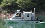 Frontier |
| Survey Equipment | Survey Info | Data Type(s) | Data Collected |
|---|---|---|---|
| GPS | --- | Navigation | Best file with nav in ArcInfo E00 format Global positioning system (GPS) data w-c5-09-mb.060 (Provisional best file) |
| samples | --- | Biology Chemistry Geology |
