AKA: none
Other ID: Y-1-04-SC
Status: Completed
Organization(s): USGS, Pacific Coastal and Marine Science Center
Funding Program(s): Santa Clara River Project (MU252)
Principal Investigator(s): Jingping Xu
Affiliate Investigator(s):
Information Specialist(s): Jingping Xu
Data Type(s): Location-Elevation: Navigation, Time Series: Mooring (physical oceanography)
Scientific Purpose/Goals: Deploy Moorings 735-739.
Vehicle(s):
Start Port/Location: Ventura Harbor, CA
End Port/Location: Ventura Harbor, CA
Start Date: 2004-01-17
End Date: 2004-01-23
Equipment Used: tripod, GPS, instrumentmooring
Information to be Derived: Waves, currents, temperature, salinity, and sediment data will be collected for 3 to 4 months. Instruments will be recovered in May 2003.
Summary of Activity and Data Gathered: This is a cruise for deploying 3 tripods and one surface mooring to measure potential hyperpycnal flow from Santa Clara river during flood.
Staff: Dave Gonzales, Kevin Orzech, Hal Williams, Joanne Thede
Affiliate Staff:
Notes:
Staff information imported from InfoBank
Jingping Xu (USGS Western Region) - Chief Scientist
Joanne Ferreira (USGS Western Region) - Technician
Dave Gonzales (USGS Western Region) - Electrical Technician
Hal Williams (USGS Western Region) - Mechanical Technician
Kevin Orzech (USGS Western Region) - Geologist
Location:
Ventura Harbor boatyard
| Boundaries | |||
|---|---|---|---|
| North: 34.2392 | South: 34.22917 | West: -119.278 | East: -119.27647 |
Platform(s):
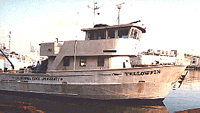 Yellowfin |
| Survey Equipment | Survey Info | Data Type(s) | Data Collected |
|---|---|---|---|
| tripod | --- | Mooring (physical oceanography) | |
| GPS | --- | Navigation | Best file with nav in ArcInfo E00 format Global positioning system (GPS) data (Provisional best file) |
| instrumentmooring | --- | Geology Mooring (physical oceanography) |
