AKA: none
Other ID: Z-1-07-SC
Status: Completed
Organization(s): USGS, Pacific Coastal and Marine Science Center
Funding Program(s):
Principal Investigator(s): James Conrad, Peter Dartnell
Affiliate Investigator(s):
Information Specialist(s): David Finlayson
Data Type(s): Imagery: Video, Location-Elevation: Navigation, Seismics: Boomer, Seismics: Sub Bottom Profiler
Scientific Purpose/Goals: Conduct sea floor mapping operations in support of surficial geologic and benthic habitat mapping within State waters of the Santa Barbara Channel. Also, to map the distribution of natural gas seeps.
Vehicle(s):
Start Port/Location: Santa Barbara
End Port/Location: Ventura
Start Date: 2007-06-26
End Date: 2007-07-15
Equipment Used: Submetrix, subbottomprofiler, YoNav, underwatervideo, Chirp
Information to be Derived: bathymetry, acoustic backscatter, sub-bottom profiles, sea floor video, and navigation
Summary of Activity and Data Gathered:
Staff: Michael Boyle, Peter Dartnell, Brian Edwards, David Finlayson, Larry Kooker, Diane Minasian, Thomas Reiss, Peter Triezenberg
Affiliate Staff:
Eleyne Phillips - sea floor video interpretation
Merit McCrea - UC Santa Barbara biologist
Notes: Mob/Patch; June 26 - June 28: Kooker, Boyle, Finlayson, Dartnell Leg1 (sub-x and chirp); June 28 - July 8: Kooker, Boyle, Finlayson, mammal watcher, Dartnell (thru 7/2), Conrad (7/3 - 7/8) Leg2 (video); July 9 - 14: Hatcher, Edwards, Phillips, Dartnell, McCrea Demob; July 15: Boyle (?), Hatcher, Dartnell files on /imgarc2/Z-1-07-SC
Staff information imported from InfoBank
Pete Dartnell - chief scientist
Jamie Conrad (chief scientist) - co
Mike Boyle - mechanical technician
Larry Kooker - electronics technician
David Finlayson - sea floor mapper
Brian Edwards - sea floor video interpretation
Eleyne Phillips - sea floor video interpretation
Merit McCrea - UC Santa Barbara biologist
Diane Minasian - mammal observer
Peter Triezenberg - mammal observer
Tom Reiss - onshore survey support
Location:
Santa Barbara Channel
| Boundaries | |||
|---|---|---|---|
| North: 34.46856 | South: 34.06501 | West: -120.3165 | East: -119.12616 |
Platform(s):
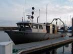 Zephyr |
Johnson, S.Y., Dartnell, P., Cochrane, G.R., Golden, N.E., Phillips, E.L., Ritchie, A.C., Kvitek, R.G., Greene, H.G., Krigsman, L.M., Endris, C.A., Clahan, K.B., Sliter, R.W., Wong, F.L., Yoklavich, M.M., and Normark, W.R.(S.Y.J., ed.), 2012, California State Waters Map Series--Hueneme Canyon and vicinity, California: U.S. Geological Survey Scientific Investigations Map 3225, 41 p.
FAN Z107SC has data viewable in the CMGP Video and Photograph Portal. View the data in this application here. See the instructions for working with this application.
| Survey Equipment | Survey Info | Data Type(s) | Data Collected |
|---|---|---|---|
| Submetrix | --- | Sub Bottom Profiler | |
| subbottomprofiler | --- | Sub Bottom Profiler | |
| YoNav | --- | Navigation | Best file with nav in ArcInfo E00 format Global positioning system (GPS) data (Provisional best file) |
| underwatervideo | --- | Video | z107sc_video_observations (This part of DS 781 presents video observations from cruise Z107SC in southern California. The vector data file is included in ""z107sc_video_observations.zip,"" which is accessible from https://pubs.usgs.gov/ds/781/video_observations/data_catalog_video_observations.html.
Between 2006 and 2007, the seafloor southern California was mapped by California State University, Monterey Bay, Seafloor Mapping Lab (CSUMB) and by the U.S. Geological Survey (USGS), using both multibeam echosounders and bathymetric sidescan sonar units. These mapping missions combined to collect bathymetry and acoustic-backscatter data from about the 10-m isobath to out beyond the 3-nautical-mile limit of California's State Waters. To validate the interpretations of sonar data in order to turn it into geologically and biologically useful information, the USGS ground-truth surveyed the data by towing camera sleds over specific locations throughout the region. During the 2008 ground-truth cruise, the camera sled housed two video cameras (one forward looking and the other vertical looking), a high-definition video camera, and an 8-megapixel digital still camera. The video was fed in real time to the research vessel, where USGS and NOAA scientists recorded both the geologic and biologic character of the seafloor into programmable keypads once every minute. In addition to recording the seafloor characteristics, a digital still photograph was captured once every 30 seconds. This ArcGIS shape file includes the position of the camera, the time each observation was started, and the visual observations of geologic and biologic habitat.) |
| Chirp | --- | Boomer |
