AKA: none
Other ID: Z-1-10-SC
Status: Completed
Organization(s):
Funding Program(s): Coastal and Marine Catastrophic Hazards (ZP00C4A)
Principal Investigator(s):
Affiliate Investigator(s): David Caress
Information Specialist(s): James Conrad
Data Type(s): Location-Elevation: Navigation, Seismics: Boomer, Sonar: Multibeam
Scientific Purpose/Goals: High-resolution bathymetric and sub-bottom survey of selected parts of the San Diego Trough fault to identify target sites for additional sampling to determine time of most recent fault movement and slip rate.
Vehicle(s):
Start Port/Location: Moss Landing, CA
End Port/Location: Moss Landing, CA
Start Date: 2010-08-10
End Date: 2010-08-23
Equipment Used: GPS, Chirp, submetrix
Information to be Derived: High-resolution bathymetry and sub-bottom seismic profiles
Summary of Activity and Data Gathered:
Staff:
Affiliate Staff:
Notes: USGS contracted for 2 18-hour surveys of selected areas using the MBARI AUV, conducted on Aug. 21-22, 2010
Location:
southern California
| Boundaries | |||
|---|---|---|---|
| North: 33.5 | South: 32.8 | West: -118.7 | East: -117.2 |
Platform(s):
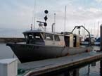 Zephyr |
| Survey Equipment | Survey Info | Data Type(s) | Data Collected |
|---|---|---|---|
| GPS | --- | Navigation | Best file with nav in ArcInfo E00 format Global positioning system (GPS) data |
| Chirp | --- | Boomer | |
| submetrix | --- | Interferometric Multibeam |
