AKA: none
Other ID: Z-2-06-SC
Status: Completed
Organization(s): USGS, Pacific Coastal and Marine Science Center
Funding Program(s): National Seafloor Mapping and Benthic Habitat Studies (MU195)
Principal Investigator(s): Guy Cochrane, Peter Dartnell, Amy Draut, Amy East
Affiliate Investigator(s):
Information Specialist(s): James Conrad
Data Type(s): Imagery: Video, Location-Elevation: Navigation, Sonar: Interferometric, Sonar: Multibeam, Sonar: Sidescan
Scientific Purpose/Goals: Seafloor mapping using Submetrix sonar and video groundtruthing to characterize substrate type along parts of the Santa Barbara coast
Vehicle(s):
Start Port/Location: Ventura Harbor
End Port/Location: Ventura Harbor
Start Date: 2006-07-06
End Date: 2006-07-26
Equipment Used: submetrix, video, GPS, sidescansonar
Information to be Derived: bathymetry, acoustic backscatter, water-bottom video
Summary of Activity and Data Gathered:
Staff: Michael Boyle, Guy Cochrane, Scott Cross, Peter Dartnell, Amy Draut, David Finlayson, Gerry Hatcher, Andy Stevenson
Affiliate Staff:
Neomi Mustain - watchstander
Donna Schroeder - biologist
Brayton Pointner - ship captain
Notes: Cochrane, Guy, Mapping the Sea Floor Off Santa Barbara, California, Sept 2006 Sound Waves, http://soundwaves.usgs.gov/2006/09/fieldwork2.html files on /imgarc2/Z-2-06-SC
Staff information imported from InfoBank
Guy Cochrane - chief scientist
Pete Dartnell - chief scientist
Amy Draut - geologist
Mike Boyle - electronics technician
Gerry Hatcher - electronics technician
Andy Stevenson - sonar specialist
Jamie Conrad - information specialist
Neomi Mustain - watchstander
David Finlayson - sonar specialist
Donna Schroeder - biologist
Scott Cross - ship captain
Brayton Pointner - ship captain
Location:
Santa Barbara Channel
| Boundaries | |||
|---|---|---|---|
| North: 34.47285 | South: 34.21149 | West: -119.921 | East: -119.2631 |
Platform(s):
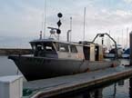 Zephyr |
Lorenson, T.D., Hostettler, F.D., Rosenbauer, R.J., Peters, K.E., Kvenvolden, K.A., Dougherty, J.A., Gutmacher, C.E., Wong, F.L., and Normark, W.R., 2009, Natural offshore seepage and related tarball accumulation on the California coastline; Santa Barbara Channel and the southern Santa Maria Basin; source identification and inventory: U.S. Geological Survey Open-File Report 2009-1225, 116 p., http://pubs.usgs.gov/of/2009/1225/.
FAN Z206SC has data viewable in the CMGP Video and Photograph Portal. View the data in this application here. See the instructions for working with this application.
| Survey Equipment | Survey Info | Data Type(s) | Data Collected |
|---|---|---|---|
| submetrix | --- | Interferometric Multibeam | |
| video | --- | Video | z206sc_video_observations (This part of DS 781 presents video observations from cruise Z206SC in southern California. The vector data file is included in ""z206sc_video_observations.zip,"" which is accessible from https://pubs.usgs.gov/ds/781/video_observations/data_catalog_video_observations.html.
Between 2006 and 2007, the seafloor in southern California was mapped by California State University, Monterey Bay, Seafloor Mapping Lab (CSUMB) and by the U.S. Geological Survey (USGS), using both multibeam echosounders and bathymetric sidescan sonar units. These mapping missions combined to collect bathymetry and acoustic-backscatter data from about the 10-m isobath to out beyond the 3-nautical-mile limit of California's State Waters. To validate the interpretations of sonar data in order to turn it into geologically and biologically useful information, the USGS ground-truth surveyed the data by towing camera sleds over specific locations throughout the region. During the 2008 ground-truth cruise, the camera sled housed two video cameras (one forward looking and the other vertical looking), a high-definition video camera, and an 8-megapixel digital still camera. The video was fed in real time to the research vessel, where USGS and NOAA scientists recorded both the geologic and biologic character of the seafloor into programmable keypads once every minute. In addition to recording the seafloor characteristics, a digital still photograph was captured once every 30 seconds. This ArcGIS shape file includes the position of the camera, the time each observation was started, and the visual observations of geologic and biologic habitat.) |
| GPS | --- | Navigation | Global positioning system (GPS) data z-2-06-sc.060 Global positioning system (GPS) data z-2-06-sc.061 Global positioning system (GPS) data z-2-06-sc.064 Global positioning system (GPS) dataz-2-06-sc.063 Global positioning system (GPS) data z-2-06-sc.062 Best file with nav in ArcInfo E00 format |
| sidescansonar | --- | Sidescan | Backscatter B [USGS]--Hueneme Canyon and Vicinity, California (This part of DS 781 presents data for part of the acoustic-backscatter map of the Hueneme Canyon and Vicinity map area, California. Backscatter data are provided as separate grids depending on mapping system or processing method. The raster data file is included in ""BackscatterB_USGS_HuenemeCanyon.zip,"" which is accessible from https://pubs.usgs.gov/ds/781/HuenemeCanyon/data_catalog_HuenemeCanyon.html. These data accompany the pamphlet and map sheets of Johnson, S.Y., Dartnell, P., Cochrane, G.R., Golden, N.E., Phillips, E.L., Ritchie, A.C., Kvitek, R.G., Greene, H.G., Krigsman, L.M., Endris, C.A., Clahan, K.B., Sliter, R.W., Wong, F.L., Yoklavich, M.M., and Normark, W.R. (S.Y. Johnson, ed.), 2012, California State Waters Map Series--Hueneme Canyon and Vicinity, California: U.S. Geological Survey Scientific Investigations Map 3225, 41 p., 12 sheets, scale 1:24,000, https://pubs.usgs.gov/sim/3225/.
The acoustic-backscatter map of Hueneme Canyon and Vicinity map area, California, was generated from backscatter data collected by California State University, Monterey Bay, Seafloor Mapping Lab (CSUMB) and by the U.S. Geological Survey (USGS). This metadata file describes the acoustic-backscatter data collected by the USGS. See https://pubs.usgs.gov/ds/781/HuenemeCanyon/metadata/BackscatterA_CSUMB_HuenemeCanyon_metadata.txt for a description of the acoustic-backscatter data collected by CSUMB. The far northern part of the Hueneme Canyon and Vicinity, California map area was mapped by the USGS in 2006, using a 117-kHz SEA (AP) Ltd. SWATHplus-M phase-differencing sidescan sonar. This mapping mission collected acoustic-backscatter data from about the 10-m isobath to almost the 3-nautical-mile limit of California's State Waters. Within the acoustic-backscater imagery, brighter tones indicate higher backscatter intensity, and darker tones indicate lower backscatter intensity. The intensity represents a complex interaction between the acoustic pulse and the seafloor, as well as characteristics within the shallow subsurface, providing a general indication of seafloor texture and sediment type. Backscatter intensity depends on the acoustic source level, the frequency used to image the seafloor, the grazing angle, the composition and character of the seafloor, including grain size, water content, bulk density, and seafloor roughness, and some biological cover. Harder and rougher bottom types such as rocky outcrops or coarse sediment typically return stronger intensities (high backscatter, lighter tones), whereas softer bottom types such as fine sediment return weaker intensities (low backscatter, darker tones).) Bathymetry Hillshade--Hueneme Canyon and Vicinity, California (This part of DS 781 present the shaded-relief bathymetry map of the Hueneme Canyon and Vicinity map area, California. The raster data file for the shaded-relief map is included in ""BathymetryHS_HuenemeCanyon.zip,"" which is accessible from https://pubs.usgs.gov/ds/781/HuenemeCanyon/data_catalog_HuenemeCanyon.html. These data accompany the pamphlet and map sheets of Johnson, S.Y., Dartnell, P., Cochrane, G.R., Golden, N.E., Phillips, E.L., Ritchie, A.C., Kvitek, R.G., Greene, H.G., Krigsman, L.M., Endris, C.A., Clahan, K.B., Sliter, R.W., Wong, F.L., Yoklavich, M.M., and Normark, W.R. (S.Y. Johnson, ed.), 2012, California State Waters Map Series--Hueneme Canyon and Vicinity, California: U.S. Geological Survey Scientific Investigations Map 3225, 41 p., 12 sheets, scale 1:24,000, https://pubs.usgs.gov/sim/3225/. The shaded-relief bathymetry map of the Hueneme Canyon and Vicinity map area, California, was generated from bathymetry data collected by California State University, Monterey Bay, Seafloor Mapping Lab (CSUMB), by the U.S. Geological Survey (USGS), and by Fugro Pelagos for the U.S. Army Corps of Engineers (USACE) Joint Lidar Bathymetry Technical Center of Expertise. Most of the offshore area was mapped by CSUMB in the summers of 2006 and 2007, using a 244-kHz Reson 8101 multibeam echosounder. The far northern part of the offshore area was mapped by the USGS in 2006, using a 117-kHz SEA (AP) Ltd. SWATHplus-M phase-differencing sidescan sonar. The nearshore bathymetry and coastal topography were mapped for USACE by Fugro Pelagos in 2009, using the SHOALS-1000T bathymetric-lidar and Leica ALS60 topographic-lidar systems. All these mapping missions combined to collect bathymetry from the 0-m isobath to beyond the 3-nautical-mile limit of California's State Waters.) Bathymetry--Hueneme Canyon and Vicinity, California (This part of DS 781 presents data for the bathymetry map of the Hueneme Canyon and Vicinity map area, California. The raster data file for the bathymetry map is included in ""Bathymetry_HuenemeCanyon.zip,"" which is accessible from https://pubs.usgs.gov/ds/781/HuenemeCanyon/data_catalog_HuenemeCanyon.html. These data accompany the pamphlet and map sheets of Johnson, S.Y., Dartnell, P., Cochrane, G.R., Golden, N.E., Phillips, E.L., Ritchie, A.C., Kvitek, R.G., Greene, H.G., Krigsman, L.M., Endris, C.A., Clahan, K.B., Sliter, R.W., Wong, F.L., Yoklavich, M.M., and Normark, W.R. (S.Y. Johnson, ed.), 2012, California State Waters Map Series--Hueneme Canyon and Vicinity, California: U.S. Geological Survey Scientific Investigations Map 3225, 41 p., 12 sheets, scale 1:24,000, https://pubs.usgs.gov/sim/3225/. The bathymetry map of the Hueneme Canyon and Vicinity map area, California, was generated from bathymetry data collected by California State University, Monterey Bay (CSUMB), by the U.S. Geological Survey (USGS), and by Fugro Pelagos for the U.S. Army Corps of Engineers (USACE) Joint Lidar Bathymetry Technical Center of Expertise. Most of the offshore area was mapped by CSUMB in the summers of 2006 and 2007, using a 244-kHz Reson 8101 multibeam echosounder. The far northern part of the offshore area was mapped by the USGS in 2006, using a 117-kHz SEA (AP) Ltd. SWATHplus-M phase-differencing sidescan sonar. The nearshore bathymetry and coastal topography were mapped for USACE by Fugro Pelagos in 2009, using the SHOALS-1000T bathymetric-lidar and Leica ALS60 topographic-lidar systems. These mapping missions combined to collect bathymetry from the 0-m isobath to beyond the 3-nautical-mile limit of California's State Waters.) Contours--Hueneme Canyon and Vicinity, California (This part of DS 781 presents data for the bathymetric contours of the Hueneme Canyon and Vicinity map area, California. The vector data file is included in ""Contours_HuenemeCanyon.zip,"" which is accessible from https://pubs.usgs.gov/ds/781/HuenemeCanyon/data_catalog_HuenemeCanyon.html. These data accompany the pamphlet and map sheets of Johnson, S.Y., Dartnell, P., Cochrane, G.R., Golden, N.E., Phillips, E.L., Ritchie, A.C., Kvitek, R.G., Greene, H.G., Krigsman, L.M., Endris, C.A., Clahan, K.B., Sliter, R.W., Wong, F.L., Yoklavich, M.M., and Normark, W.R. (S.Y. Johnson, ed.), 2012, California State Waters Map Series—-Hueneme Canyon and Vicinity, California: U.S. Geological Survey Scientific Investigations Map 3225, 41 p., 12 sheets, scale 1:24,000, https://pubs.usgs.gov/sim/3225/. The bathymetry map of Hueneme Canyon and Vicinity map area in southern California was generated from bathymetry data collected by California State University, Monterey Bay (CSUMB), by the U.S. Geological Survey (USGS), and by Fugro Pelagos for the U.S. Army Corps of Engineers (USACE) Joint Lidar Bathymetry Technical Center of Expertise. Most of the offshore area was mapped by CSUMB in the summers of 2006 and 2007, using a 244-kHz Reson 8101 multibeam echosounder. The far-northern part of the offshore area was mapped by the USGS in 2006, using a 117-kHz SEA (AP) Ltd. SWATHplus-M phase-differencing sidescan sonar. The nearshore bathymetry and coastal topography were mapped for USACE by Fugro Pelagos in 2009, using the SHOALS-1000T bathymetric-lidar and Leica ALS60 topographic-lidar systems. All these mapping missions combined to collect bathymetry from the 0-m isobath to beyond the 3-nautical-mile limit of California's State Waters. To generate contours, a smooth arithmetic mean convolution function was applied to the bathymetry. Following smoothing, contour lines were generated at 10-meter intervals from -10 m to -100 m and at 50-meter intervals from -100 m to -400 m.) |
