AKA: none
Other ID: Z-4-07-SC
Status: Completed
Organization(s): USGS, Pacific Coastal and Marine Science Center
Funding Program(s): Applied sediment transport (ZP009TV)
Principal Investigator(s): Patrick Barnard
Affiliate Investigator(s):
Information Specialist(s): Kurt Rosenberger
Data Type(s): Location-Elevation: Navigation, Sampling: Biology, Sampling: Geology
Scientific Purpose/Goals: Groundtruthing flying eyball camera data
Vehicle(s):
Start Port/Location: Santa Barbara, CA
End Port/Location: Ventura, CA
Start Date: 2007-10-09
End Date: 2007-10-12
Equipment Used: boxcore, GPS, grab
Information to be Derived: Grain size, visual sediment descriptions
Summary of Activity and Data Gathered: Sediment to be collected to ground truth video and flying eyball camera data.
Staff:
Affiliate Staff:
Notes: Sediment Transport
Location:
Santa Barbara Littoral Cell
| Boundaries | |||
|---|---|---|---|
| North: 34.41278 | South: 34.08933 | West: -119.876 | East: -119.05505 |
Platform(s):
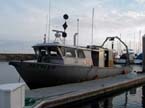 Zephyr |
| Survey Equipment | Survey Info | Data Type(s) | Data Collected |
|---|---|---|---|
| boxcore | --- | Biology Geology | |
| GPS | --- | Navigation | Arc Station Locations Station Locations |
| grab | --- | Geology |
