AKA: none
Other ID: B-1-72-SC,BARTLETT 72
Status: Completed
Organization(s): USGS, Pacific Coastal and Marine Science Center
Funding Program(s):
Principal Investigator(s): Gary Greene
Affiliate Investigator(s):
Information Specialist(s):
Data Type(s): Electro-Magnetic: Gravity, Electro-Magnetic: Magnetics, Location-Elevation: Navigation, Sampling: Geology, Seismics: Air Gun / Water Gun, Seismics: Boomer, Seismics: Sonobuoy, Sonar: Single Beam
Scientific Purpose/Goals:
Vehicle(s):
Start Port/Location:
End Port/Location:
Start Date: 1972-11-09
End Date: 1972-11-15
Equipment Used: bathymetry, airgunarcer, gravity, magnetics, dredge, integratednavigation, uniboom
Information to be Derived:
Summary of Activity and Data Gathered:
Staff:
Affiliate Staff:
Notes: Staff information imported from InfoBank
Gary Greene (USGS Western Region) - Chief Scientist
Eli Silver (USGS Western Region) - Chief Scientist
Location:
Central California
| Boundaries | |||
|---|---|---|---|
| North: 37.71533 | South: 32.40505 | West: -123.652 | East: -117.38731 |
Platform(s):
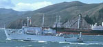 Bartlett |
Greene, H.G., Silver, E.A., and von Huene, R.E., 1975, Seismic reflection profiles November 1972 cruise, USNS Bartlett, offshore Central and southern California: U.S. Geological Survey Open-File Report 75-121, http://pubs.er.usgs.gov/publication/ofr75121.
Kennedy, D.J., Balster-Gee, A.F., Sliter, R.W., and Kluesner, J.W., 2022, Reprocessed legacy seismic-reflection data from USGS field activity B-1-72-SC collected offshore central and southern California: U.S. Geological Survey data release, https://doi.org/10.5066/P9EK7CG3.
Steele, W.C., Degnan, C.H., Deeter, G.B., and Riordan, J.A., 1989, Description of marine geophysical data collected by the U.S. Geological Survey and how to obtain it: U.S. Geological Survey Open-File Report 89-167, 26 p., https://pubs.er.usgs.gov/publication/ofr89167.
Vedder, J.G., 1990, Maps of California continental borderland showing compositions and ages of bottom samples acquired between 1968 and 1979: U.S. Geological Survey Miscellaneous Field Studies Map 2122, 3 p., https://doi.org/10.3133/mf2122.
Vedder, J.G., and Howell, D.G., 1979, Geologic framework of the southern California borderland: U. S. Geological Survey Professional Paper 1150, pp. 146–147.
Vedder, J.G., Beyer, L.A., Junger, A., Moore, G.W., Roberts, A.E., Taylor, J.C., and Wagner, H.C., 1974, Preliminary report on the geology of the continental borderland of Southern California: U. S. Geological Survey Miscellaneous Field Studies Map 624, 34 p., https://doi.org/10.3133/mf624.
Vedder, J.G., Crouch, J.K., Scott, E.W., Greene, H.G., Cranmer, D., Ibrahim, M., Tudor, R.B., and Vinning, G., 1980, A summary report of the regional geology, petroleum potential, environmental geology, and operational considerations in the area of proposed lease sale no. 68, offshore southern California: U.S. Geological Survey Open-File Report 80-198, 64 p.
Vedder, J.G., Taylor, J.C., Arnal, R.E., and Bukry, D., 1976, Map showing location of selected pre-Quaternary rock samples from the California continental borderland: U. S. Geological Survey Miscellaneous Field Studies Map 737, https://doi.org/10.3133/mf737.
