The image displayed on this page is a thumbnail, please use the download function to obtain the full-resolution image.
Filename: 2022-034-FA_NCB_sandsnap_8.jpg
This image is part of the data release:
Topographic, bathymetric, multispectral, vegetation, sediment, and supporting GPS data collected on North Core Banks, Cape Lookout National Seashore, North Carolina in October 2022, U.S. Geological Survey Field Activity 2022-034-FA
Image data:
- Keywords:
- Physical habitats and geomorphology
- Collection:
2022 NCB SandSnaps
- Field activity number:
2022-034-FA:
More images from FAN |
CMGDS details
- Topic: Citizen Science, Geology
- Purpose: Field activity
- Class: Core or Sample
- Subject: sand
- Semantic Location: North Core Banks
- Science Center: St. Petersburg Coastal and Marine Science Center, Woods Hole Coastal and Marine Science Center
- File Size: 6174412 bytes
Imagery header data:
- Credit: U.S. Geological Survey
- Contact: WHSC_data_contact@usgs.gov
- Copyright: Public Domain
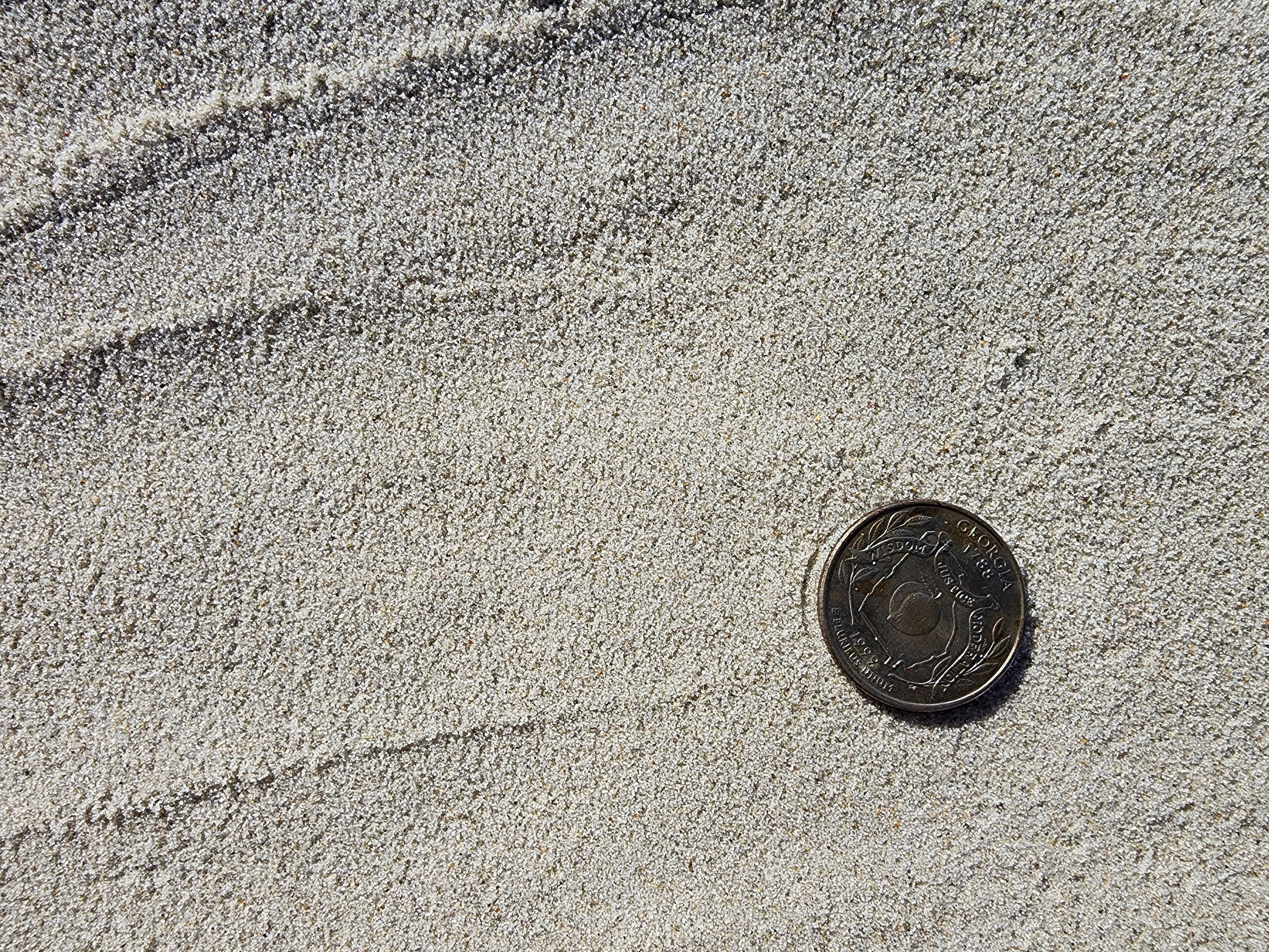
- Image Description: https://cmgds.marine.usgs.gov/fan_info.php?fan=2022-034-FA ; SandSnap image of the ground with a quarter for scale, North Core Banks, Cape Lookout National Seashore, North Carolina
- Attribution URL: https://doi.org/10.5066/P99IV3FC
- GPS Latitude: 34.8404657
- GPS Latitude Reference: N
- GPS Longitude: -76.3380753997222
- GPS Longitude Reference: W
- GPS Time Stamp (UTC): 09:52:43
- GPS Date Stamp: 2022-10-20
- GPS Area Information: camera-integrated GPS
- GPS Map Datum: EPSG:4326 (WGS 84)
- Date/Time Original: 2022-10-20 09:52:43
- Date/Time Modified: 2022-10-20 09:52:43
- PID (Image Unique ID): DA8XLOD00AM
- Artist: WHCMSC AIMG
- Preserved Filename: 2022-034-FA_NCB_sandsnap_8.jpg
- External Metadata Link: https://www.sciencebase.gov/catalog/file/get/63af033ed34e92aad3ca5ed3?name=2022034FA_NCB_SandSnap_meta.xml
- Camera Make: Samsung
- Camera Model: SM-S908U