The image displayed on this page is a thumbnail, please use the download function to obtain the full-resolution image.
Filename: F07_20170808T222638Z_RA000390.JPG
This image is part of the data release:
Aerial imagery from UAS surveys of the beaches at Fort Stevens State Park, OR, and Cape Disappointment State Park, WA
Image data:
- Keywords:
- Collection:
Benson Beach UAS, 2017-666-FA
- Field activity number:
2017-666-FA:
More images from FAN |
CMGDS details
- Topic: Mapping, Remote Sensing, and Geospatial Data
- Purpose: Field activity
- Class: Uncrewed Aircraft System
- Subject: Benson Beach
- Semantic Location: Benson Beach, Cape Disappointment State Park, Washington
- Science Center: Pacific Coastal and Marine Science Center
- File Size: 5811378 bytes
Imagery header data:
- Credit: U.S. Geological Survey
- Contact: pcmsc_data@usgs.gov
- Copyright: Public Domain
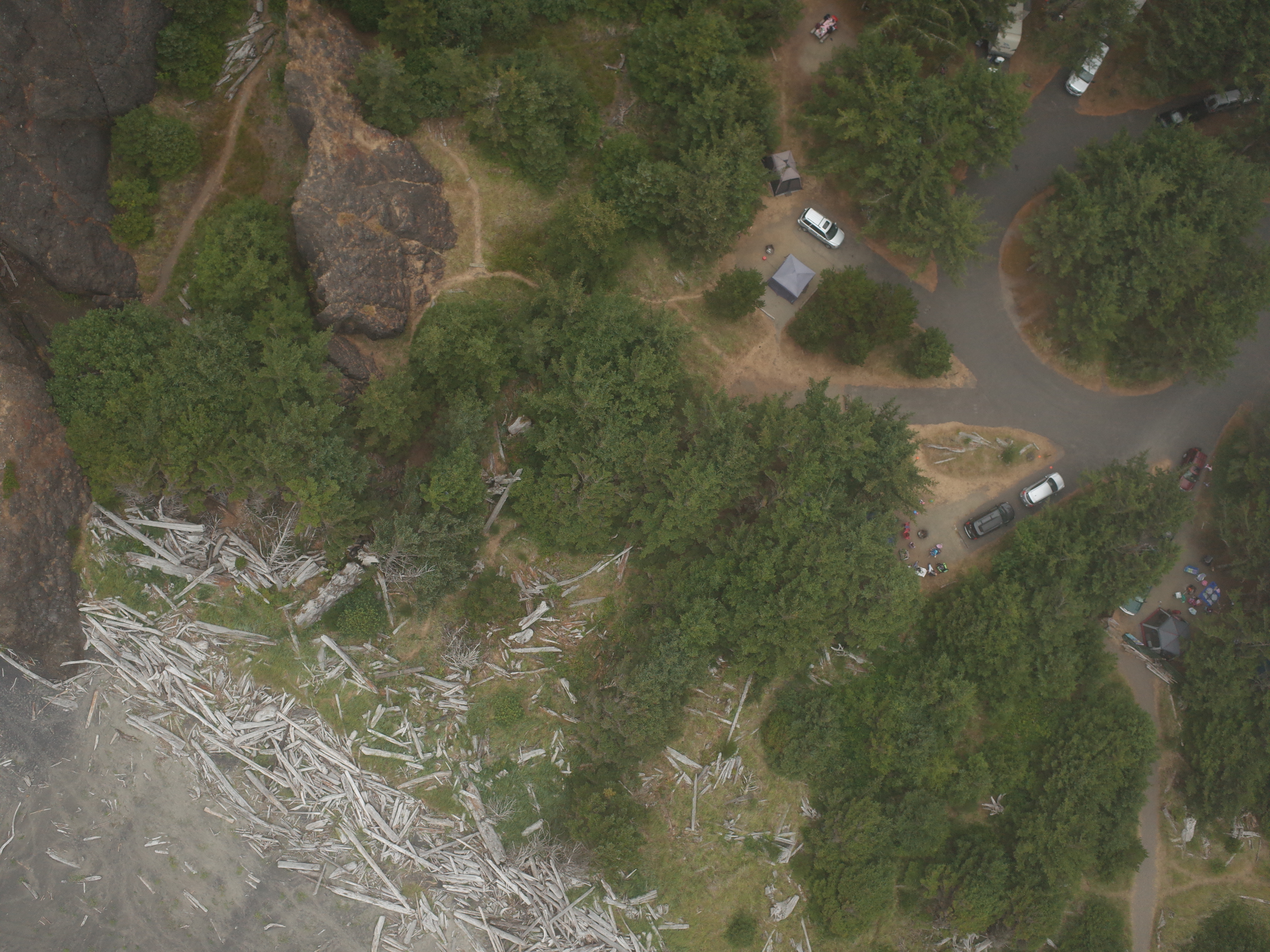
- Image Description: Aerial image of Benson Beach at Cape Disappointment State Park, Washington, USA, from USGS Unoccupied Aircraft System (UAS) survey 2017-666-FA (https://cmgds.marine.usgs.gov/fan_info.php?fan=2017-666-FA), conducted under Washington State Parks and Recreation Commission Scientific Research Permit 170603
- Attribution URL: https://doi.org/10.5066/P9BVTVAW
- GPS Latitude: 46.2955341000111
- GPS Latitude Reference: N
- GPS Longitude: -124.075123099978
- GPS Longitude Reference: W
- GPS Time Stamp (UTC): 22:27:54
- GPS Date Stamp: 2017-08-08
- GPS Area Information: Position from UAS onboard autonomous single-frequency GNSS.
- GPS Map Datum: EPSG:4979 (WGS 84)
- Date/Time Original: 2017-08-08 15:26:38
- Date/Time Modified: 2017-08-08 15:26:38
- Artist: U.S. Geological Survey, Pacific Coastal and Marine Science Center
- Preserved Filename: F07_20170808T222638Z_RA000390.JPG
- External Metadata Link: https://www1.usgs.gov/pir/api/identifiers/USGS:6435bd4fd34ee8d4addaf826
- Camera Make: RICOH IMAGING COMPANY, LTD.
- Camera Model: GR II