U.S. Geological Survey, 200508, ECSTDB2005 - USGS East Coast Sediment Texture Database (2005): Open-File Report 2005-1001, U.S. Geological Survey, Coastal and Marine Geology Program, Woods Hole Science Center, Woods Hole, MA.This is part of the following larger work.Online Links:
- <http://pubs.usgs.gov/of/2005/1001/data/surficial_sediments/ecstdb2005.zip>
- <http://pubs.usgs.gov/of/2005/1001/htmldocs/datacatalog.htm>
Poppe, L.J., Williams, S.J., and Paskevich, V.F., 2005, USGS East-Coast Sediment Analysis: Procedures, Database, and GIS Data: Open-File Report 2005-1001, U.S. Geological Survey, Coastal and Marine Geology Program, Woods Hole Science Center, Woods Hole, MA.Online Links:
This is a Point data set. It contains the following vector data types (SDTS terminology):
Horizontal positions are specified in geographic coordinates, that is, latitude and longitude. Latitudes are given to the nearest 0.000001. Longitudes are given to the nearest 0.000001. Latitude and longitude values are specified in Decimal degrees.
The horizontal datum used is North American Datum of 1927.
The ellipsoid used is Clarke 1866.
The semi-major axis of the ellipsoid used is 6378206.400000.
The flattening of the ellipsoid used is 1/294.978698.
Coordinates defining the features.
Sequential unique whole numbers that are automatically generated.
| Value | Definition |
|---|---|
| 1 | Samples taken before start of the joint USGS/WHOI project. |
| 2 | USGS/WHOI Atlantic Continental Margin Program stations |
| 3 | samples analyzed by the USGS Branch of Atlantic Marine Geology Sediment Laboratory |
Character string of width 21.
Character string of width 21.
Character string of width 12.
Character string of width 33.
| Range of values | |
|---|---|
| Minimum: | -16.2320670 |
| Maximum: | 69.4609 |
| Units: | signed decimal degrees |
| Resolution: | ,00000001 |
| Range of values | |
|---|---|
| Minimum: | -170.52 |
| Maximum: | 123.55683 |
| Units: | signed decimal degrees |
| Resolution: | .00000001 |
| Range of values | |
|---|---|
| Minimum: | 0.00 |
| Maximum: | 5001.00 |
| Units: | meters |
| Resolution: | .01 |
| Range of values | |
|---|---|
| Minimum: | 0 |
| Maximum: | 115049 |
| Units: | centimeters |
| Resolution: | 1 |
| Range of values | |
|---|---|
| Minimum: | 0 |
| Maximum: | 115054 |
| Units: | centimeters |
| Resolution: | 1 |
| Value | Definition |
|---|---|
| 1 METER PLANKTON NET | |
| 1-METER DREDGE | |
| 3/4 METER PLANKTON NE | |
| 35MM STEREO CAMERA+DRED | |
| ANCHOR DREDG | |
| ANCHOR FLUKES | |
| ANCHOR SAMPLE | |
| BLAKE TRAWL | |
| BOOMERANG CORER | |
| BOT DRIFTER SALINOMETER | |
| BOTTOM DRIFTER | |
| BOTTOM DRIFTER BUG | |
| BOTTOM SKIMMER | |
| BOX CORE | |
| BOX SAMPLER | |
| CAM GRAB W/O CAM+PLANK T | |
| CAMERA SLED | |
| CAMPBELL GRAB W/ CAMERA | |
| CAMPBELL GRAB W/O CAMERA | |
| CHAIN BAG | |
| CHAIN BAG DREDGE | |
| CHAIN BAG+PIPE DREDGE | |
| CHAIN BAG+SM PIPE DREDGE | |
| CHAIN BAG+PIPE | |
| CHAIN BAG+PIPE DREDGE | |
| CHAIN BAG+SM PIPE | |
| CHAIN BAG+SM PIPE DREDGE | |
| CHAIN DREDGE | |
| CORING TUBE IN MECH ARM | |
| D-L SNAPPER | |
| D-L SNAPPER + DREDGE | |
| D-L SNAPPER + GRAV COR | |
| DIETZ-LAFOND | |
| DIETZ-LAFOND GRAB | |
| DIETZ-LAFOND SNAPPER | |
| DIGBY DREDGE | |
| DIGBY DREDGE W/ CNVS BAG | |
| DRAG DREDGE | |
| DREDGE | |
| Drilled Sample | |
| DRILLED SAMPLE | |
| EDGERTON CAMERA | |
| GOS ANCHOR CHAIN | |
| GRAB SAMPLER | |
| GRAPPLING HOOK | |
| GRAVITY CORER | |
| HAND SAMPLE | |
| Hand Sample | |
| HYDROSTATIC CORE | |
| HYDROSTATIC CORER | |
| Hydrostatic CORER | |
| IKU GRAB | |
| JAPANESE DREDGE | |
| M-VV GRAB + D-LF SNAPPER | |
| M-VV GRAB + GRAVITY CORE | modified Van Veen grab sampler and gravity corer |
| MECH ARM + CORE DRILL | |
| MECH ARM W/ CORER | |
| MECH ARM W/ PRY BAR | |
| MECHANICAL ARM | |
| MINIATURE VAN VEEN | |
| MINIATURE VAN VEEN W/O C. | |
| MODIFIED PIERCE DREDGE | |
| NA | |
| NATURALIST DREDGE | |
| NISKIN SAMPLER | |
| OTHER | |
| PAUL CORER | |
| PIPE DREDGE | |
| PIPE DREDGE AND D-L SNAP | |
| PIPE DREDGE, 12 INCH | |
| PISTON CORER | |
| PONAR SAMPLER | |
| PULSE AUGER | |
| PUSH CORER | |
| Pulse Auger | |
| RAKED INTO BASKET W/ ARM | |
| RING NET | |
| ROCKER DREDGE | |
| ROTARY CORER | |
| ROTOSONIC CORER | |
| SALINOMETER, VANDORN BOTS | |
| SCALLOP DREDGE | |
| SCOOP FISH | |
| SEDIMENT TRAP | |
| SHIPEK GRAB | |
| SMALL VAN VEEN | small Van Veen grab sampler |
| SMITH-MAC+MIN W, CAMERA | |
| SMITH-MACINTYRE GRAB | Smith-MacIntyre grab sampler |
| SMITH-MACINTYRE W/ CAMERA | |
| SMITH-MACINTYRE W/O CAMERA | |
| SMITH/MAC AND NISKIN SPL | |
| SUBMERSIBLE SAMPLE | |
| Submersible Sample | |
| TRAWL | |
| TRIGGER CORE | |
| UNKNOWN | |
| VAN VEEN AND CORE | |
| VAN VEEN GRAB | sample collected with Van Veen grab sampler |
| Van Veen Grab | sample collected with Van Veen grab sampler |
| VIBRA CORE | |
| VISUAL OBSERVATION | |
| VV GRAB + D-L SNAPPER | |
| WATER PUMP ONLY |
Character string of width 28.
| Value | Definition |
|---|---|
| blank | Month sample was collected is unknown. |
| Range of values | |
|---|---|
| Minimum: | 1 |
| Maximum: | 12 |
| Units: | month of year |
| Resolution: | 1 |
| Value | Definition |
|---|---|
| blank | Day sample was collected is unknown. |
| Range of values | |
|---|---|
| Minimum: | 1 |
| Maximum: | 31 |
| Units: | day of month |
| Resolution: | 1 |
| Value | Definition |
|---|---|
| blank | Year sample connected is unknown. |
| Range of values | |
|---|---|
| Minimum: | 1955 |
| Maximum: | 1999 |
| Units: | year |
| Resolution: | 1 |
| Value | Definition |
|---|---|
| blank | Month sample was analyzed is unknown |
| Range of values | |
|---|---|
| Minimum: | 1 |
| Maximum: | 12 |
| Units: | month of year |
| Resolution: | 1 |
| Value | Definition |
|---|---|
| blank | Month sample was analyzed is unknown. |
| Range of values | |
|---|---|
| Minimum: | 1 |
| Maximum: | 31 |
| Units: | day of month |
| Resolution: | 1 |
| Value | Definition |
|---|---|
| blank | Year sample was analyzed is unknown. |
| Range of values | |
|---|---|
| Minimum: | 1969 |
| Maximum: | 2000 |
| Units: | year |
| Resolution: | 1 |
| Value | Definition |
|---|---|
| (blank) | Weight not computed or recorded. |
| Range of values | |
|---|---|
| Minimum: | 0 |
| Maximum: | 9086.1 |
| Units: | grams |
| Resolution: | .0001 |
| Value | Definition |
|---|---|
| blank | Value not computed or available for sample. |
| Range of values | |
|---|---|
| Minimum: | 0.00 |
| Maximum: | 100.00 |
| Units: | percent |
| Resolution: | .01 |
| Value | Definition |
|---|---|
| blank | Value not computed or available for sample. |
| Range of values | |
|---|---|
| Minimum: | 0.00 |
| Maximum: | 103.02 |
| Units: | percent |
| Resolution: | .01 |
| Value | Definition |
|---|---|
| blank | Value not computed or available for sample. |
| Range of values | |
|---|---|
| Minimum: | 0.00 |
| Maximum: | 100.00 |
| Units: | percent |
| Resolution: | .01 |
| Value | Definition |
|---|---|
| blank | Value not computed or available for sample. |
| Range of values | |
|---|---|
| Minimum: | 0.00 |
| Maximum: | 94.71 |
| Units: | percent |
| Resolution: | .01 |
| Value | Definition |
|---|---|
| BEDROCK | |
| BOULDERS | |
| CLAY | |
| CLAYEY SAND | |
| CLAYEY SILT | |
| GRAVEL | |
| GRAVELLY SEDIMENT | |
| SAND | |
| SAND SILT CLAY | |
| SANDY CLAY | |
| SANDY SILT | |
| SILT | |
| SILTY CLAY | |
| SILTY SAND |
Character string of width 19.
| Value | Definition |
|---|---|
| blank | Value not computed or available for sample. |
| Range of values | |
|---|---|
| Minimum: | -7.35 |
| Maximum: | 10.74 |
| Units: | phi |
| Resolution: | .01 |
| Value | Definition |
|---|---|
| blank | Value not computed or available for sample. |
| Range of values | |
|---|---|
| Minimum: | -5.93 |
| Maximum: | 10.62 |
| Units: | phi |
| Resolution: | .01 |
| Value | Definition |
|---|---|
| blank | Value not computed or available for sample. |
| Range of values | |
|---|---|
| Minimum: | -0.08 |
| Maximum: | 7.16 |
| Units: | phi |
| Resolution: | .01 |
| Value | Definition |
|---|---|
| blank | Value not computed or available for sample. |
| Range of values | |
|---|---|
| Minimum: | -4217.60 |
| Maximum: | 123907.67 |
| Units: | phi |
| Resolution: | .01 |
| Value | Definition |
|---|---|
| blank | Value not computed or available for sample. |
| Range of values | |
|---|---|
| Minimum: | -968709.00 |
| Maximum: | 357391.91 |
| Units: | phi |
| Resolution: | .01 |
| Value | Definition |
|---|---|
| blank | Value not computed or available for sample. |
| Range of values | |
|---|---|
| Minimum: | -7.500 |
| Maximum: | 10.600 |
| Value | Definition |
|---|---|
| blank | Value not computed or available for sample. |
| Range of values | |
|---|---|
| Minimum: | 0.00 |
| Maximum: | 100.00 |
| Units: | percent |
| Resolution: | .01 |
| Value | Definition |
|---|---|
| blank | Value not computed or available for sample. |
| Range of values | |
|---|---|
| Minimum: | -7.50 |
| Maximum: | 13.40 |
| Units: | phi |
| Resolution: | .01 |
| Value | Definition |
|---|---|
| blank | Value not computed or available for sample. |
| Range of values | |
|---|---|
| Minimum: | 0.00 |
| Maximum: | 60.50 |
| Units: | percent |
| Resolution: | .01 |
| Range of values | |
|---|---|
| Minimum: | -6.50 |
| Maximum: | 15.40 |
| Units: | phi |
| Resolution: | .01 |
| Value | Definition |
|---|---|
| blank | Value not computed or available for sample. |
| Range of values | |
|---|---|
| Minimum: | -2.50 |
| Maximum: | 18.15 |
| Units: | percent |
| Resolution: | .01 |
| Value | Definition |
|---|---|
| blank | Value not computed or available for sample. |
| Range of values | |
|---|---|
| Minimum: | 0 |
| Maximum: | 5 |
| Units: | integer count |
| Resolution: | 1 |
| Range of values | |
|---|---|
| Minimum: | 0.00 |
| Maximum: | 100.00 |
| Units: | percent |
| Resolution: | .01 |
| Range of values | |
|---|---|
| Minimum: | 0.00 |
| Maximum: | 100.00 |
| Units: | percent |
| Resolution: | .01 |
| Range of values | |
|---|---|
| Minimum: | 0.00 |
| Maximum: | 100.00 |
| Units: | percent |
| Resolution: | .01 |
| Range of values | |
|---|---|
| Minimum: | -1.00 |
| Maximum: | 64.43 |
| Units: | percent |
| Resolution: | .01 |
| Range of values | |
|---|---|
| Minimum: | 0.00 |
| Maximum: | 97.00 |
| Units: | percent |
| Resolution: | .01 |
| Range of values | |
|---|---|
| Minimum: | -19.73 |
| Maximum: | 86.00 |
| Units: | percent |
| Resolution: | .01 |
| Range of values | |
|---|---|
| Minimum: | 0.00 |
| Maximum: | 92.67 |
| Units: | percent |
| Resolution: | .01 |
| Range of values | |
|---|---|
| Minimum: | 0.00 |
| Maximum: | 96.00 |
| Units: | percent |
| Resolution: | .01 |
| Range of values | |
|---|---|
| Minimum: | 0.00 |
| Maximum: | 94.66 |
| Units: | percent |
| Resolution: | .01 |
| Range of values | |
|---|---|
| Minimum: | 0.00 |
| Maximum: | 92.75 |
| Units: | percent |
| Resolution: | .01 |
| Range of values | |
|---|---|
| Minimum: | 0.00 |
| Maximum: | 80.51 |
| Units: | percent |
| Resolution: | .01 |
| Range of values | |
|---|---|
| Minimum: | 0.00 |
| Maximum: | 68.32 |
| Units: | percent |
| Resolution: | .01 |
| Range of values | |
|---|---|
| Minimum: | 0.00 |
| Maximum: | 47.57 |
| Units: | percent |
| Resolution: | .01 |
| Range of values | |
|---|---|
| Minimum: | 0.00 |
| Maximum: | 47.90 |
| Units: | percent |
| Resolution: | .01 |
| Range of values | |
|---|---|
| Minimum: | -3.87 |
| Maximum: | 45.55 |
| Units: | percent |
| Resolution: | .01 |
| Range of values | |
|---|---|
| Minimum: | 0.00 |
| Maximum: | 54.63 |
| Units: | percent |
| Resolution: | .01 |
| Range of values | |
|---|---|
| Minimum: | 0.00 |
| Maximum: | 55.71 |
| Units: | percent |
| Resolution: | .01 |
Character string of width 43.
Character string of width 154.
Character string of width 72.
Character string of width 66.
The U.S. Geological Survey must be referenced as the originator of the dataset in any future products or research derived from these data.
(508) 548-8700 x2314 (voice)
(508) 457-2310 (FAX)
[email protected]
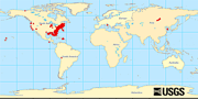
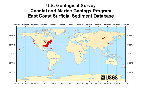
This ArcView shapefile contains the locations of marine sediment samples collected and analyzed by the U.S. Geological Survey, Woods Hole Science Center starting in 1962 thru 1999. Distribution of this dataset allows the user the ability to visualize the information in a Geographic Information system.
Person who carried out this activity:
(508) 548-8700 (voice)
(508) 457-2310 (FAX)
Data sources produced in this process:
Person who carried out this activity:
(508) 548-8700 x2314 (voice)
(508) 457-2310 (FAX)
[email protected]
Data sources produced in this process:
Person who carried out this activity:
(508) 540-8700 x2277 (voice)
(508) 457-2310 (FAX)
[email protected]
Data sources produced in this process:
Poppe(ed.), Lawrence J. , and Polloni(ed.), Chris, 20000501, USGS East-Coast Sediment Analysis: Procedures, Database, and Georeferenced Displays: Open-File Report 00-358, U.S. Geological Survey, Coastal and Marine Geology Program, Woods Hole Science Center, Woods Hole, MA.Online Links:
Positional accuracy varies due to different systems, datums, and navigational equipment used over the years.
This data set is complete inasmuch as it contains all the samples processed at the U.S. Geological Survey (USGS), Woods Hole Science Center (WHSC) Sediment Laboratory through November 2004
No additional checks for topological consistency were performed on this data.
Are there legal restrictions on access or use of the data?
- Access_Constraints: None
- Use_Constraints:
- Public domain data from the U.S. government is freely redistributable with proper metadata and source attribution.
(508) 548-8700 x2314 (voice)
(508) 457-2310 (FAX)
[email protected]
Downloadable Data
Although this data set has been used by the U.S. Geological Survey (USGS), no warranty, expressed or implied, is made by the USGS as to the accuracy of the data and/or related materials. The act of distribution shall not constitute any such warranty, and no responsibility is assumed by the USGS in the use of these data or related materials.Trade, firm, or product names and other references to non-USGS products and services are provided for information only and do not constitute endorsement or warranty, express or implied, by the USGS, USDOI, or U.S. Government, as to their suitability, content, usefulness, functioning, completeness, or accuracy.
| Data format: | The SHP file contains the geospatial data. The SHX file contains the index of the geospatial data. The DBF file contains the attribute data in dBASE format. The PRJ file contains the coordinate system information (optional). The AVL file contains the legend information (optional). The SBN and SBX files contain the spatial index of the geospatial data (optional). The XML file contains the metadata describing the data set <data set name>.shp.xml. An ASCII version of the metadata file. A browse graphic showing the data layer coverage and extent (optional). in format Shapefile (version ArcView 3.3) ESRI Shapefile Size: 18.875 |
|---|---|
| Network links: | <http://pubs.usgs.gov/of/2005/1001/data/surficial_sediments/ecstdb2005.zip> <http://coastalmap.marine.usgs.gov/GISdata/sedsamples/ecstdb2005/ecstdb2005.zip> <http://pubs.usgs.gov/of/2005/1001/htmldocs/datacatalog.htm> |
| Media you can order: | DVD-ROM
(Density 4.7
Gbyte)
Note: HFS and ISO9660 |
These data are available in Environmental Systems Research Institute (ESRI) shapefile format. The user must have ArcGIS® or ArcView® 3.0 or greater software to read and process the data file. In lieu of ArcView or ArcGIS, the user may utilize another GIS application package capable of importing data. A free data viewer, arcexplorer, capable of displaying the data is available from ESRI at www.esri.com.
(508) 548-8700 x2314 (voice)
(508) 457-2310 (FAX)
[email protected]
Downloadable Data
Although this data set has been used by the U.S. Geological Survey (USGS), no warranty, expressed or implied, is made by the USGS as to the accuracy of the data and/or related materials. The act of distribution shall not constitute any such warranty, and no responsibility is assumed by the USGS in the use of these data or related materials.Any use of trade, product, or firm names is for descriptive purposes only and does not imply endorsement by the U.S. Government.
| Data format: | Excel spreadsheet containing the data source. in format Microsoft Excel (version Office 2000) Microsoft Excel spreadsheet |
|---|---|
| Network links: | <http://pubs.usgs.gov/of/2005/1001/data/surficial_sediments/ecstdb2005.xls> |
| Media you can order: | DVD-ROM
(Density 4.75
Gbyte)
Note: HFS and ISO9660 |
| Data format: | Data exported from the source spreadsheet. in format ASCII Comma delimited text file |
|---|---|
| Network links: | <http://pubs.usgs.gov/of/2005/1001/data/surficial_sediments/ecstdb2005.txt> |
| Media you can order: | DVD-ROM
(Density 4.75
Gbyte)
Note: HFS and ISO9660 |
(508) 548-8700 x2281 (voice)
(508) 457-2310 (FAX)
[email protected]