
 |
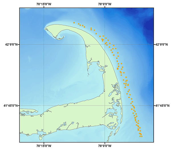
RAFA04011_BOTPHOTOS.SHP: Location of Sea-Floor Photographs acquired during USGS cruise 04011 (RAFA04011) from off Eastern Cape Cod, Massachusetts |
Metadata also available as: FAQ | TEXT
Any use of trade, product, or firm names is for descriptive purposes only and does not imply endorsement by the U.S. Government.
Any use of trade, product, or firm names is for descriptive purposes only and does not imply endorsement by the U.S. Government.
Any use of trade, product, or firm names is for descriptive purposes only and does not imply endorsement by the U.S. Government.