Woods Hole Science Center
OFR 2005-1048 Home / Introduction / Geologic Setting / GIS Data Catalog / Bottom Photographs
U.S. Geological Survey Open-File Report 2005-1048
Geological Interpretation of Bathymetric and Backscatter Imagery of the Sea Floor Off Eastern Cape Cod, Massachusetts
|
|
Figure 20
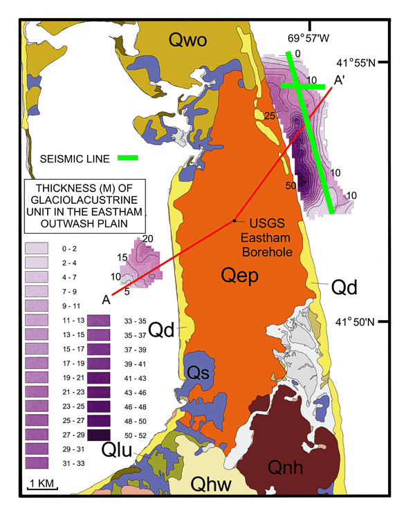
Map from Foster and Poppe (2003) showing the distribution and thickness of fine-grained glaciolacustrine deposits of the Eastham outwash plain on the Atlantic and Cape Cod Bay sides of the outer Cape. Green lines show the locations of seismic lines shown in
Figure 21 and
22; red line shows the location of cross section A-A’ shown in
Figure 23. Qep: Eastham outwash plain; Qd: undifferentiated glacial drift; Qwo: Wellfleet outwash plain; Qhw: Harwich outwash plain; Qnh: Nauset Heights ice-contact deposits; Qs: swamp and marsh deposits; Qlu: Cape Cod Bay lake deposits. |
|
|
|
|