Skip USGS links group
U.S. Geological Survey - science for a changing world
CZM logo with link to CZM home page

Woods Hole Science Center

End of USGS links group

OFR 2005-1048 Home / Introduction / Geologic Setting / GIS Data Catalog / Bottom Photographs

Skip title; go to table of contents Skip title; go to table of contents

U.S. Geological Survey Open-File Report 2005-1048

Geological Interpretation of Bathymetric and Backscatter Imagery of the Sea Floor Off Eastern Cape Cod, Massachusetts
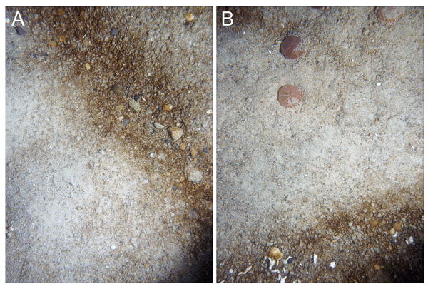

Figure 30

Figure 30: Bottom photographs showing representative views of the sea floor off Orleans.

Bottom photographs showing representative views of the sea floor off Orleans. A) Gravel and organics collect in the ripple troughs at station CC33. B) Gravel shell debris, and organics collect in the ripple troughs and sand dollars congregate on the ripple crests at station CC35. Sand dollars are approximately 7 cm in diameter; long dimension of the sea-floor area shown is approximately 0.8 m.


Skip footer Table of Contents; Go to Footer OFR 2005-1048 Home / Introduction / Geologic Setting / GIS Data Catalog / Bottom Photographs

Skip Navigation

Accessibility FOIA Privacy Policies and Notices

U.S. Department of the Interior | U.S. Geological Survey | Coastal and Marine Geology

URL: cmgds.marine.usgs.gov/publications/of2005-1048/htmldocs/figures/f30_orleansbphoto.htm
Page Contact Information: CMGDS Team
Page Last Modified: Wednesday, 06-Dec-2017 12:35:15 EST