 | |
USGS Open-File Report 2005-1162, Sidescan-Sonar Imagery and Surficial Geologic Interpretation of the Sea Floor off Bridgeport, Connecticut
Title Page | Introduction | Geologic Setting | Data/Processing | Bathymetry | Sidescan | Catalog | Figures | References| Contacts
 |
 |
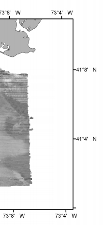 |
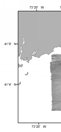
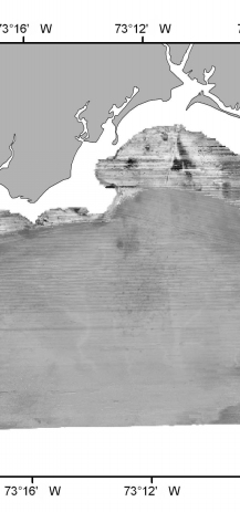
Sidescan-Sonar Imagery: 24 bit grayscale, composite sidescan-sonar mosaic produced by NOAA of survey h11045 off Bridgeport, Connecticut (UTM zone 18, WGS84 spheroid). Click for larger image. | ||