USGS Coastal and Marine Hazards and Resources Program
![]() Title | Geologic Setting | Introduction
| Methods | Bathymetric Overview |
Interpretation | Data Catalog
| Acknowledgments | References
| Figures
| Contacts
Title | Geologic Setting | Introduction
| Methods | Bathymetric Overview |
Interpretation | Data Catalog
| Acknowledgments | References
| Figures
| Contacts
 |
||
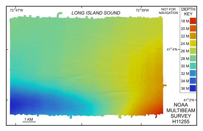
Figure 4. Digital terrain model (DTM) of the sea floor in southeastern Long Island Sound produced from multibeam bathymetry collected during NOAA survey H11255. Image is sun-illuminated from the north and vertically exaggerated 10X. Hotter colors are shallower areas; cooler colors are deeper areas. See key for depth ranges. | ||
