USGS Coastal and Marine Hazards and Resources Program
![]() Title | Geologic Setting | Introduction
| Methods | Bathymetric Overview |
Interpretation | Data Catalog
| Acknowledgments | References
| Figures
| Contacts
Title | Geologic Setting | Introduction
| Methods | Bathymetric Overview |
Interpretation | Data Catalog
| Acknowledgments | References
| Figures
| Contacts
 |
||
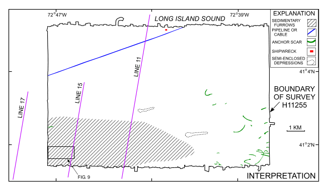
Figure 8. Interpretation of the bathymetry from NOAA survey H11255. Shown is the area characterized by sedimentary furrows. Also shown are the locations of a pipeline/cable, anchor scars, a shipwreck, semi-enclosed depressions, the detailed multibeam view of the sea floor shown in Figure 9, and the locations of the seismic profiles shown in figure 5, figure 6, and figure 7. | ||
