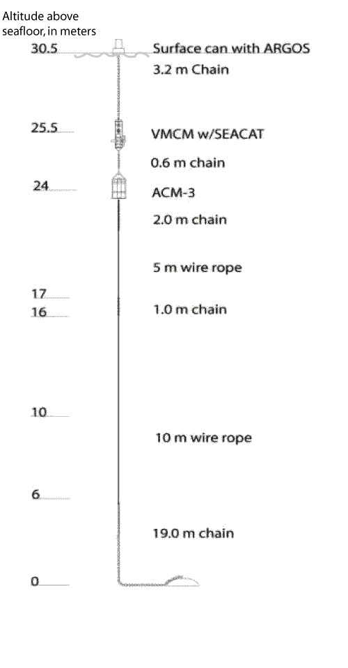
Figure 7C. Schematic diagram of a surface mooring to be deployed at 30.5 meters, with ARGOS telemetry of position. This mooring has both acoustic and mechanical current meters. Surface moorings are used to obtain near-surface measurements and often to mark the experiment location to protect the instruments from accidental entanglement.