| Identifier | 09CCT01 | ||||||||
|---|---|---|---|---|---|---|---|---|---|
| Purpose | Conduct offshore geophysical investigations to identify storm impact on seafloor features. | ||||||||
| Location | Galveston, TX | ||||||||
| Summary | 500 km of survey lines (planned) | ||||||||
| Info derived | High-resolution seismic-reflection profiles, bathymetry dataset, shoal locations and volume, and a seafloor basemap. | ||||||||
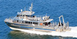
| Comments | Platform: R/V Manta (NOAA). | ||||||||
| Platform |
|
||||||||
| Itinerary |
|
||||||||
| Bounds |
|
||||||||
| Marine operations | Yes |
| Organization |
600 Fourth Street South
St. Petersburg, FL33701-4846
(727) 502-8000
|
||||||
|---|---|---|---|---|---|---|---|
| Principal investigators | James G Flocks | ||||||
| Crew members |
|
||||||
| Information specialist(s) |
|
| Data category: | Location-Elevation, Seismics, Sonar |
|---|---|
| Data type: | Navigation, Sub Bottom Profiler, Interferometric, Multibeam |
| Equipment | Usage description | Data types | Datasets |
|---|---|---|---|
| Interferometric Bathymetry System | Interferometric | (no data reported) | |
| F190 DGPS/IMU | Navigation | (no data reported) | |
| Chirp 512i | Sub Bottom Profiler | 5 | |
| Global Positioning System (GPS) | Navigation | 2 |
| Dataset name | Equipment | Description | Dataset contact |
|---|---|---|---|
| 09CCT01-SE-pd-1 | Chirp 512i | Chirp 512i navigation | Arnell S Forde |
| 09CCT01-SE-pd-2 | Chirp 512i | Chirp 512i profiles | Arnell S Forde |
| 09CCT01-SE-pd-3 | Chirp 512i | Chirp 512i GIS | Arnell S Forde |
| 09CCT01-SE-pd-5 | Chirp 512i | Chirp 512i agc SEGY | Arnell S Forde |
| 09CCT01-SE-rd-1 | Chirp 512i | Chirp 512i | Arnell S Forde |
| Processed 1,000-Shot-Interval Location Navigation | Global Positioning System (GPS) | Arnell S Forde | |
| Processed Shotpoint Navigation | Global Positioning System (GPS) | Arnell S Forde |