| Identifier | 10CCT02 | ||||||||
|---|---|---|---|---|---|---|---|---|---|
| Purpose | To create a complete modern topobathymetric map of the Mississippi barrier islands from Cat Island to Dauphin Island. Data to provide information for the following: sediment budget; assessment of immediate sand resources in the region, modern geologic framework; historical island change measurements; base-level assessment of the seafloor since the 2005 hurricane season | ||||||||
| Location | Horn Island, MS to Dauphin Island, AL | ||||||||
| Summary | A total of 192 chirp 2-D sub-bottom profiles, 192 swath, and 102 side scan lines were collected. | ||||||||
| Info derived | Submetrix swath bathymetry data; shallow sub-botom image profiles and, side-scan sonar mosaics | ||||||||
| Comments | Shop Staff (Pre-Cruise) - Dave Wegener contributed 1.5 weeks to design and fabrication; Richard Young was boat captain during 2 days of Side Scan equipment testing. Additional equipment: L3900 Klein Side Scan Towfish. | ||||||||
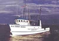
| Platform |
|
||||||||
| Itinerary |
|
||||||||
| Bounds |
|
||||||||
| Marine operations | Yes |
| Organization |
600 Fourth Street South
St. Petersburg, FL33701-4846
(727) 502-8000
|
||||||||||||
|---|---|---|---|---|---|---|---|---|---|---|---|---|---|
| Principal investigators | James G Flocks | ||||||||||||
| Crew members |
|
||||||||||||
| Information specialist(s) |
|
| Data category: | Other, Electro-Magnetic, Imagery, Location-Elevation, Seismics, Sonar |
|---|---|
| Data type: | Unknown, Resistivity, Photo, Benchmarks, Navigation, Profiles, Transects, Sub Bottom Profiler, Multibeam, Sidescan, Sound Velocity |
| Equipment | Usage description | Data types | Datasets |
|---|---|---|---|
| Interferometric Bathymetry System | Interferometric | 5 | |
| Ashtech Z-Xtreme DGPS | Benchmarks, Navigation | 4 | |
| Chirp 512i | Sub Bottom Profiler | 5 | |
| Klein Side Scan Sonar | Sidescan | 2 | |
| Valeport SVP | Sound Velocity | (no data reported) | |
| Camera, Digital, Hand Held | Photo | (no data reported) | |
| F190 DGPS/IMU | Navigation | (no data expected) |
| Dataset name | Equipment | Description | Dataset contact |
|---|---|---|---|
| 10cct02_bathy_cover | Interferometric Bathymetry System | Interferometric swath bathymetric grid in PDF layout | Nancy T DeWitt |
| 10cct02_swss_overlay | Interferometric Bathymetry System | Sidescan sonar backscatter and interferometric swath bathymetry composite grid as PDF layout | Nancy T DeWitt |
| 10cct02_sw_v2_50m | Interferometric Bathymetry System | Interferometric swath bathy grid as GeoTiff, 50-m resolution | James G Flocks |
| DS 577 ArcGIS_Project | Interferometric Bathymetry System | Data Series 577 GIS dataset | Nancy T DeWitt |
| Sample10cct02_1m | Interferometric Bathymetry System | Composite ASCII file of sidescan sonar mosaic pixel values and bathymetric depth | Nancy T DeWitt |
| 10CCT02-NL-pd-1 | Ashtech Z-Xtreme DGPS | HYPACK navigation tracklines in shapefile format | Nancy T DeWitt |
| 10CCT02-NL-pd-2 | Ashtech Z-Xtreme DGPS | HYPACK navigation tracklines in PDF layout | Nancy T DeWitt |
| 10CCT02-NL-pd-3 | Ashtech Z-Xtreme DGPS | Interferometric swath bathymetry tracklines in PDF layout | Nancy T DeWitt |
| 10CCT02-NL-pd-4 | Ashtech Z-Xtreme DGPS | Sidescan sonar tracklines in PDF layout | Nancy T DeWitt |
| 10CCT02-SE-pd-1 | Chirp 512i | Chirp 512i data navigation | Arnell S Forde |
| 10CCT02-SE-pd-2 | Chirp 512i | Chirp 512i data profiles | Arnell S Forde |
| 10CCT02-SE-pd-3 | Chirp 512i | Chirp 512i data GIS | Arnell S Forde |
| 10CCT02-SE-pd-4 | Chirp 512i | Chirp 512i data GeoMapApp | Arnell S Forde |
| 10CCT02-SE-pd-5 | Chirp 512i | Chirp 512i data agc SEGY | Arnell S Forde |
| 10CCT02-BS-pd-1 | Klein Side Scan Sonar | Sidescan sonar mosaic as Geotiff | Nancy T DeWitt |
| 10CCT02-BS-pd-2 | Klein Side Scan Sonar | Sidescan sonar mosaic as PDF layout | Nancy T DeWitt |