| Identifier | 13BHM01 | ||||||||
|---|---|---|---|---|---|---|---|---|---|
| Purpose | Establish baseline values for regional carbon flux between sea and air. | ||||||||
| Location | Gulf of America (Gulf of Mexico), vicinity of Pensacola | ||||||||
| Info derived | DIC, pCO2, pH, Alkalinity, T, S, Chlorophyll | ||||||||
| Projects | |||||||||
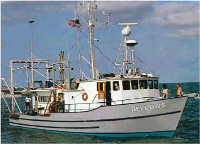
| Platform |
|
||||||||
| Vehicles | None |
||||||||
| Itinerary |
|
||||||||
| Bounds |
|
| Organization |
600 Fourth Street South
St. Petersburg, FL33701-4846
(727) 502-8000
|
||||
|---|---|---|---|---|---|
| Principal investigators | Lisa L Robbins | ||||
| Crew members |
|
||||
| Information specialist(s) |
|
||||
| Affiliate principal | Kendra Daly (USF-St. Petersburg) |
| Data category: | Environmental Data, Location-Elevation, Sampling |
|---|---|
| Data type: | pH, Navigation, Chemistry |
| Equipment | Usage description | Data types | Datasets |
|---|---|---|---|
| Global Positioning System (GPS) | Navigation | 1 | |
| YSI Professional Plus Multiparameter Meter | Conductivity, Depth, Dissolved Oxygen, Nitrate, ORP, pH, Temperature | 1 | |
| Rosette Sampler | Chemistry | 1 |
| Dataset name | Equipment | Description | Dataset contact |
|---|---|---|---|
| 2013_July_Navigation | Global Positioning System (GPS) | Navigational data collected by the research vessel | Lisa L Robbins |
| 2013_July_Samples_Surface | YSI Professional Plus Multiparameter Meter | Seawater surface samples collected in transit | Lisa L Robbins |
| 2013_July_Samples_Station | Rosette Sampler | Seawater samples of the water column collected at specific sample sites | Lisa L Robbins |