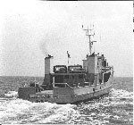
Obtain quasi-synoptic information on the suspended-sediment transport system within the South Texas OCS. Specific objectives were: to obtain samples of the water column for analyses of sediment texture and concentrations, sediment mineralogy and trace metals, water chemistry, and coccoliths to establish temporal variability patterns; to obtain vertical transmittance-temperature profiles to establish regional turbidity patterns; and to cast drift bottles to measure surface currents during the cruise period.
Location
south Texas outer continental shelf, Matagorda Bay, Texas, Gulf of America (Gulf of Mexico), United States, North America, North Atlantic;
Summary
This cruise was the fifth of six scheduled cruises designed to evaluate the temporal variability of suspended-sediment transport patterns within the South Texas OCS region. The remaining cruise is scheduled for May 1977. Vertical transmittance-temperature profiles: 26; Water column samples (surface, mid, bottom): 78 samples at 26 stations; Drift bottles: 312 casts.
Info derived
Time series data; Samples and chemical analysis; Suspended sediment concentrations;
Comments
Original Center People field contained: USGS-Corpus Christi: Gerald Shideler - Ch. Sci., Ronald Miller, Kenneth Roberts, Fran Firek, Charles Stelting, Cyndi Rice, William Allshouse, Stan Linquist, Ronald Circe, Jack Kindinger, Pat Dave Nichols, Neal Lillard.
Project = South Texas Outer Continental Shelf (STOCS), South Texas Outer Continental Shelf (STOCS)