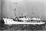
Acquire seismic, bathymetric, and sedimentologic data from previously unsampled portion of the Puerto Rico insular shelf and slope north of Culebra Island and provide alternate research goals for the ill-fated Puerto Rico Trench cruise of the R/V EASTWARD E-1b and c-80.
Location
insular shelf and slope between Puerto Rico and St. Thomas, north of Isla de Culebra, Puerto Rico, and south southwest of St. Thomas, Virgin Islands, United States, North America, North Atlantic;
Summary
Retrieved 62 bucket and shipek grab sediment samples from the insular shelf north of Culebra and south southwest of St. Thomas; 42 short gravity cores from slope areas north of Culebra and south of St. Thomas; 900 nautical miles of 3.5 kHz seismic record of the slope and shelf; 317 nautical miles of the 20 cu. in. airgun record in the slope north of Culebra; and 41 nautical miles of 20 cu in. airgun record on the slope south west of St. Thomas. All airgun data is recorded on magnetic tape. Data will be jointly worked up by Bill Cleary, Orrin Pilkey, and USGS-San Juan personnel.
Comments
Original Center People field contained: Kurt Grove - USGS-San Juan; Al Goodman - Technician, Woods Hole; Barry Irwin - Technician, Woods Hole; John West - USGS-Corpus Christi.
Project = Puerto Rico Marine Geology Co-op, Puerto Rico Marine Geology Co-op