Field Activity 1986-004-FA

Identifier 1986-004-FA
Alternate names GM 86-06
Purpose Bathymetric survey of Corsair Canyon and Georges Bank.
Location eastern Georges Bank, Corsair Canyon, United States, North America, North Atlantic;
Summary Because of adverse weather conditions, the survey was limited to a total of 18.5 hours in Corsair Canyon area. 3.5 kHz data: 167 km.
Comments Project = Biostratigraphic and Depositional Framework - U.S. Atlantic Margin, Biostratigraphic and Depositional Framework - U.S. Atlantic Margin
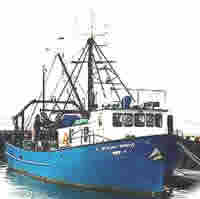
Platform
Gloria Michelle
65 feet
Itinerary
Start Davisville, RI 1986-04-20
End Woods Hole, MA 1986-04-24
Days in the field 5
Bounds
West -69
East -66.21667
North 41.4
South 41

Personnel

Organization
384 Woods Hole Road
Quissett Campus
Woods Hole, MA02543-1598
(508) 548-8700
Principal investigators Page C Valentine
Crew members
David C Twichell
Scientist, Staff
Page C Valentine
Scientist, Staff
Mateus, Steve
Scientist, Staff
Information specialist(s)
Page C Valentine
Specialist, Information
Affiliate staff Clifford Newell (NMFS), Tom Meyer (NMFS)

Data types and categories

Data category: Seismics, Location-Elevation
Data type: Sub Bottom Profiler, Navigation

Documents: Notes and log books

Name Description
Cruise report Chief Scientist's report including personnel, equipment, description, and a trackmap.

Equipment used

Equipment Usage description Data types Datasets
3.5 kHz Sub Bottom Profiler (no data reported)
Northstar 6000 LORAN-C Navigation (no data reported)

Publications

Samples collected during this field activity