| Identifier | 1989-003-FA | ||||||||
|---|---|---|---|---|---|---|---|---|---|
| Purpose | The overall objective of the 12th cruise leg 1 of the R/V PETROV was to initiate an integrated geological sampling and geophysical surveying program of the Mid-Atlantic Ridge between the Atlantis Fracture Zone and the Hayes Fracture Zone, from 30 degrees N to 34 degrees N. The sampling and survey program was designed to address specific scientific objectives related to understanding the geological, geochemical, and geodynamic processes that help to control the generation and subsequent deformation of oceanic lithosphere. These scientific objectives are summarized as follows: 1) Establishing the morphotectonic framework of the axial Mid-Atlantic Ridge by: a. identifying and mapping the large-offset and the "zero-offset transform/fracture zones and the variability in their fault systems; b. identifying and mapping the axial bathymetric high, rift-valley graben, and flanking fault blocks including the segmentation characteristics of the ridge; and c. identifying and mapping magnetic lineations that provide age-isochron information and other magnetic signatures that reflect magmatic processes at the ridge. 2) Establishing the magmatic contribution to oceanic crustal generation by: a. determining the geochemical variations along the ridge axis in young oceanic crust; b. examining the relationships between these variations and ridge segmentation; and c. examining of small-scale variations at large-offset, small-offset, and zero-offset transform zones. 3) Investigating the deformation of oceanic crust within transform/fracture zones by: establishing the metamorphic character of mafic and ultramafic rocks, including microfabric, fluid-inclusion, and geochemical evidence. | ||||||||
| Location | Atlantis Fracture Zone, Hayes Fracture Zone, Mid-Atlantic Ridge axis, North Atlantic; | ||||||||
| Comments | Project = Mid-Atlantic Ridge Crest Processes, Mid-Atlantic Ridge Crest Processes Information from Foghorn:All geophysical measurement and geologic sampling systems provided by the Soviets: Multibeam bathymetric mapping system; Gravity system; Magnetometer system; Navigation system; Single-Channel Seismic Reflection Profiling System; Deep-Sea Winch and Barrel Dredge Rock Sampling System; Water Chemistry and Physical Oceanography system; Added equipment AirGun based on information written on the box in the WHOI library. | ||||||||
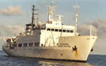
| Platform |
|
||||||||
| Itinerary |
|
||||||||
| Bounds |
|
| Organization |
384 Woods Hole Road
Quissett Campus
Woods Hole, MA02543-1598
(508) 548-8700
|
||
|---|---|---|---|
| Principal investigators | Kim D. Klitgord | ||
| Crew members |
|
||
| Affiliate principal | Leonid V. Dmitriev - Vernadsky Institute of Geochemistry | ||
| Affiliate staff | Dr. Leonid Dmitriev - Soviet co-chief scientist (Vernadsky Institute of Geochemistry, Moscow, Russia); Dr. John F. Casey - petrologist (University of Houston, Houston, TX, USA); Mr. Kevin Johnston - petrologist (MIT-WHOI joint program, Woods Hole, MA, USA); Prof. Vladimar Tulin - gravity specialist (Institute of Physics of the Earth, Moscow, Russia); Dr. Sergei Silantiev - metamorphic petrologist (Vernadsky Institute of Geochemistry, Moscow, Russia); Sergei Zahpunny - Expedition secretary, facilitator (Vernadsky Institute of Geochemistry, Moscow, Russia); Ruben Magakyan - petrologist - chief of dredge operations (Vernadsky Institute of Geochemistry, Moscow, Russia); Mikhail Reisner - computer expert (Vernadsky Institute of Geochemistry, Moscow, Russia); Matalia Kononkova - petrologist and watch stander (Institute of Geology, Moscow, Russia); Dr. Vladimar V. Mayorshin - magnetic specialist (Institute of Terrestrial Maganetism - Troizk, Moscow, Russia); Mikhail Zakharov - multibeam bathymetry specialist (Institute of Geology, Moscow, Russia); Vadim Golod - seismic specialist (Institute of Geology, Moscow, Russia); Boris Bazylev - ultramafic petrologist, dredge operations team (Vernadsky Institute of Geochemistry, Moscow, Russia); Lyudmila Polosina - thin-section lab operations (Vernadsky Institute of Geochemistry, Moscow, Russia); Olga Tsameryan - petrologist, multibeam bathymetry watch (Vernadsky Institute of Geochemistry, Moscow, Russia) |
| Data category: | Sonar, Electro-Magnetic, Sampling, Seismics |
|---|---|
| Data type: | Multibeam, Magnetics, Gravity, Biology, Geology, Air Gun / Water Gun |
| Equipment | Usage description | Data types | Datasets |
|---|---|---|---|
| Air gun | Air Gun / Water Gun | 1 | |
| Marine magnetometer | Magnetics | (no data reported) | |
| Gravity meter (wh) | Gravity | (no data reported) | |
| Dredge | Biology, Geology | (no data reported) | |
| Hollming Echos 625 multibeam | Multibeam | (no data reported) |
| Dataset name | Equipment | Description | Dataset contact |
|---|---|---|---|
| 1989-003-FA-SE-001 | Air gun | microfilm of RUSSIAN COOP-KLITGORD | Nancy K. Soderberg |