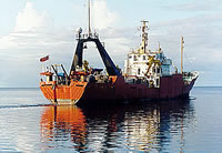
Field Activity 1990-012-FA

Identifier 1990-012-FA
Alternate names F-6-90-SC,F690SC
Purpose Survey with midrange sidescan sonar (TOBI: towed ocean bottom instrument).
Location Monterey Canyon, California, United States, North America, North Pacific;
Info derived Sea floor map;
Comments Information derived from schedule; no pre-cruise or post-cruise report found.
Platform
Farnella
230 feet
Itinerary
Start Redwood City, CA 1990-06-19
End Redwood City, CA 1990-07-14
Days in the field 26
Bounds
West -125.13648138
East -121.92758465
North 37.9441975
South 33.66340176

Personnel

Organization
384 Woods Hole Road
Quissett Campus
Woods Hole, MA02543-1598
(508) 548-8700
Principal investigators Thomas F O'Brien
Crew members
Affiliate principal Jim Gardner - USGS western region; Doug Masson - USGS western region

Data types and categories

Data category: Location-Elevation, Sonar
Data type: Navigation, Sidescan, Single Beam

Equipment used

Equipment Usage description Data types Datasets
Loran-C Navigation 1
Sidescan sonar Sidescan (no data reported)
Echosounder Single Beam 2

Datasets

Datasets produced in this activity

Dataset name Equipment Description Dataset contact
1990-012-FA-LN-001 Loran-C Navigation data Nancy K. Soderberg
Bathymetry data Echosounder Linda P McCarthy
NGDC MGD77 data - bathy Echosounder Carolyn Hayashida Degnan

Publications

Samples collected during this field activity