| Identifier | 1990-022-FA | ||||||||
|---|---|---|---|---|---|---|---|---|---|
| Alternate names | VRSH 90-1 | ||||||||
| Purpose | Map, sample and photograph lake bottom. | ||||||||
| Location | Lake Baikal, Siberia, Russia, Asia; | ||||||||
| Comments | Information derived from logs. | ||||||||
| URL | |||||||||
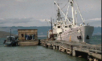
| Platform |
|
||||||||
| Itinerary |
|
||||||||
| Bounds |
|
| Organization |
384 Woods Hole Road
Quissett Campus
Woods Hole, MA02543-1598
(508) 548-8700
|
||||
|---|---|---|---|---|---|
| Principal investigators | Richard R Rendigs | ||||
| Crew members |
|
||||
| Affiliate principal | Paul Hearn - USGS, Reston | ||||
| Affiliate staff | Paul Hearn |
| Data category: | Location-Elevation, Seismics |
|---|---|
| Data type: | Navigation, Sub Bottom Profiler |
| Name | Description |
|---|---|
| Navigation log | GPS navigation log containing position, equipment configuration, and data acquisition notes. |
| Seismic log | Seismic log containing position, equipment configuration, tape and file numbers, and data acquisition notes. |
| Dataset name | Equipment | Description | Dataset contact |
|---|---|---|---|
| 1990-022-FA-LN-001 | GPS (wh) | Navigation trackline plot for field activity 90022 | Nancy K. Soderberg |
| 1990-022-FA-LN-002 | GPS (wh) | Floppy disk(s) containing NAV-GPS, NAV-GPS, NAV-GPS, NAV-GPS, NAV-GPS, NAV-GPS, NAV-GPS, BACKUPBOOT, MAGELLANBACKUP, SYSTEM+MAGELLAN, | Nancy K. Soderberg |
| 1990-022-FA-SE-001 | 3.5 kHz | Collection of paper record displays of seismic data( 3.5K) for lines | Nancy K. Soderberg |
| 1990-022-FA-SE-002 | 3.5 kHz | VHS digital tapes for line(s) 1, 1, 1, 1, 1, 1, 1, 1, 1, 1, 1, 1, 1,2, 2, 4(MCS-9), 4(MCS-9), 4(MCS-9), 4(MCS-9), VENT AREA, VENT AREA, VENT AREA, 6, 6N.BASIN, 7, 7 E.SIDE, 8, 8, 8, 8, 8, 8, 8, | Nancy K. Soderberg |
| 1990-022-FA-SE-003 | 3.5 kHz | microfilm of | Nancy K. Soderberg |