| Identifier | 1991-011-FA | ||||||||
|---|---|---|---|---|---|---|---|---|---|
| Alternate names | KIT JONES-91-1 | ||||||||
| Purpose | Collect nearshore and Mississippi Sound high-resolution seismic as part of coastal project to study coastal erosion and offshore sand resources. | ||||||||
| Location | Mississippi Sound, northern Gulf of Mexico, United States, North America, North Atlantic; | ||||||||
| Summary | Fair seismic data; bad weather. | ||||||||
| Comments | Project = AL-MS Pollution Project, AL-MS Pollution Project | ||||||||
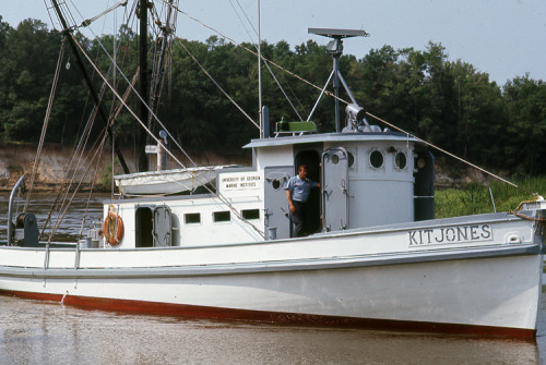
| Platform |
|
||||||||
| Itinerary |
|
||||||||
| Bounds |
|
| Organization |
384 Woods Hole Road
Quissett Campus
Woods Hole, MA02543-1598
(508) 548-8700
|
|---|---|
| Principal investigators | Kelley, Terry |
| Crew members | |
| Affiliate principal | Randy McBride - LGS |
| Affiliate staff | Dana Wiese - USGS-St. Petersburg; Mississippi Minerals Technology Center: Douglas Lockhart and Tom Shelton |
| Data category: | Seismics, Location-Elevation |
|---|---|
| Data type: | Air Gun / Water Gun, Boomer, Sparker, Navigation |
| Name | Description |
|---|---|
| Cruise report | Chief Scientist's cruise report including personnel, purpose, equipment, tabulated information, and trackmap. |
| Equipment | Usage description | Data types | Datasets |
|---|---|---|---|
| Benthos AQ-4 10-element hydrophone streamer | Air Gun / Water Gun, Boomer, Sparker | (no data reported) | |
| Boomer | Boomer | (no data reported) | |
| GPS (wh) | Navigation | (no data reported) | |
| Loran-C | Navigation | (no data reported) |