| Identifier | 1993-009-FA | ||||||||
|---|---|---|---|---|---|---|---|---|---|
| Alternate names | DLWR 93-05; DE9305 | ||||||||
| Purpose | Locate fine-grained sediments in Hudson Shelf Valley with sidescan sonar and video surveys, bottom grabs; determine extent of contamination via grabs, cores. | ||||||||
| Location | Hudson Shelf Valley, United States, North America, North Atlantic; | ||||||||
| Summary | 59 tracklines. | ||||||||
| Comments | Original Center People field contained: John Schlee - Co-Ch. Sci., Marilyn ten Brink - Co-Ch. Sci., Barry Irwin, Rick Rendigs, Ken Parolski, Eric Schmuck, Kris Caylor, Peter Cattaneo. Information from Foghorn: Sidescan sonar, Osprey video-camera-Van Veen sampler, hydrostatically damped corer, gravity corer; | ||||||||
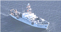
| Platform |
|
||||||||
| Itinerary |
|
||||||||
| Bounds |
|
| Organization |
384 Woods Hole Road
Quissett Campus
Woods Hole, MA02543-1598
(508) 548-8700
|
||||||||||||
|---|---|---|---|---|---|---|---|---|---|---|---|---|---|
| Principal investigators | John SchleeMarilyn ten Brink | ||||||||||||
| Crew members |
|
||||||||||||
| Affiliate principal | Mead Allison - SUNY | ||||||||||||
| Affiliate staff | Kris Caylor, Peter Cattaneo; Mead Allison - SUNY |
| Data category: | Seismics, Biological Field Study, Imagery, Sampling, Visual Identification, Location-Elevation, Sonar |
|---|---|
| Data type: | Sub Bottom Profiler, Experiments (biological), Surveys (biological), Photo, Video, Biology, Geology, Species ID, Navigation, Sidescan |
| Name | Description |
|---|---|
| Cruise report | Chief Scientist's daily narrative including of ship movement, personnel, equipment and data acquisition notes, sidescan sonar and seismic line list, trackmap. |
| Equipment | Usage description | Data types | Datasets |
|---|---|---|---|
| Slow corer | Geology | (no data reported) | |
| 3.5 kHz | Sub Bottom Profiler | 1 | |
| Sidescan sonar | Sidescan | 3 | |
| SeaBOSS | Surveys (biological), Experiments (biological), Species ID, Photo, Video, Geology, Biology | (no data reported) | |
| Gravity corer | Geology | 1 | |
| GPS (wh) | Navigation | 2 | |
| Loran-C | Navigation | (no data reported) |
| Dataset name | Equipment | Description | Dataset contact |
|---|---|---|---|
| 1993-009-FA-SE-001 | 3.5 kHz | microfilm of | Nancy K. Soderberg |
| 1993-009-FA-SO-001 | Sidescan sonar | Collection of paper record displays of sidescan sonar data for lines | Nancy K. Soderberg |
| 1993-009-FA-SO-002 | Sidescan sonar | microfilm of | Nancy K. Soderberg |
| 1993-009-FA-SO-003 | Sidescan sonar | Digital tapes of SSS LINES 1-59: inventory #6164, 6165, 6166, and 6167. | Nancy K. Soderberg |
| 1993-009-FA-SC-001 | Gravity corer | CORE, GRAB samples | Brian Buczkowski |
| 1993-009-FA-LN-001 | GPS (wh) | Navigation trackline plot for field activity 93009 | Nancy K. Soderberg |
| 1993-009-FA-LN-002-01 | GPS (wh) | Raw navigation data files. | Nancy K. Soderberg |