| Identifier | 1996-018-FA | ||||||||
|---|---|---|---|---|---|---|---|---|---|
| Purpose | Carry out a single-channel seismic reflection survey of the Chesapeake Bay impact crater. | ||||||||
| Location | Chesapeake Bay, United States, North America, North Atlantic; | ||||||||
| Info derived | Morphology; | ||||||||
| Comments | Original Center People field contained: Debbie Hutchinson - Co-Ch. Sci., Steve Colman - co-Ch. Sci.; John Evans - watchstander, Barry Irwin - navigation, Jeremy Loss - watchstander, Dave Nichols - seismics, Tom O'Brien - seismics, Nancy Soderberg - curator. Project = Chesapeake Bay, adjacent inner continental shelf, Chesapeake Bay, adjacent inner continental shelf Information from Foghorn: GI watergun system;Water gun;MassComp acquisition system;SIS-1000 sidescan sonar system, 3.5 kHz;Odom echo sounder;Ashtech GPSS XII receiver;Megapulse Accufix D100 receiver; | ||||||||
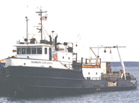
| Platform |
|
||||||||
| Itinerary |
|
||||||||
| Bounds |
|
| Organization |
384 Woods Hole Road
Quissett Campus
Woods Hole, MA02543-1598
(508) 548-8700
|
||||||||||||||||
|---|---|---|---|---|---|---|---|---|---|---|---|---|---|---|---|---|---|
| Principal investigators | Claude (Wylie) W. Poag | ||||||||||||||||
| Crew members |
|
||||||||||||||||
| Affiliate staff | Ira Block - NGS photographer (Apr. 25-26?) |
| Data category: | Location-Elevation, Seismics, Sonar |
|---|---|
| Data type: | Navigation, Transects, Air Gun / Water Gun, Sub Bottom Profiler, Single Beam, Sidescan |
| Equipment | Usage description | Data types | Datasets |
|---|---|---|---|
| SIS1000 Chirp Sonar | Sub Bottom Profiler | 1 | |
| DGPS | Navigation | 1 | |
| Water gun (wh) | Air Gun / Water Gun | (no data reported) | |
| SIS1000 Sidescan sonar | Sidescan | 1 | |
| 3.5 kHz | Sub Bottom Profiler | (no data reported) | |
| ODOM 200 kHz depth recorder | Single Beam | (no data reported) | |
| Ashtech Z-12 GPS | Navigation, Transects | (no data reported) | |
| Megapulse Accufix 500 LORAN-C | Navigation | (no data reported) | |
| Single channel hydrophone | Air Gun / Water Gun, Boomer, Bubble Gun, Sparker, Sub Bottom Profiler | 3 |
| Dataset name | Equipment | Description | Dataset contact |
|---|---|---|---|
| 1996-018-FA chirp | SIS1000 Chirp Sonar | Digital tape(s) of GI GUN L1, GI GUN L2-3, GI GUN L4, GI GUN L4-5, GI GUN L5-10, GI GUN L10-13, GI GUN L13-14, GI GUN L14-17, NO FILES?, GI GUN L1-17 SEGY, H2OGUN L3A, H2OGUN L3A,15A, SSS1000 L3A, SSS1000 L3A,15A, | Linda P McCarthy |
| 1996-018-FA-LN-001 | DGPS | Floppy disk(s) containing NAV-DGPS, NAV-DGPS, NAV-DGPS, NAV-DGPS, NAV-DGPS, NAV-DGPS, NAV-DGPS, NAV-DGPS-EDIT, NAV-DGPS-EDIT, | Nancy K. Soderberg |
| 1996-018-FA-SO-001 | SIS1000 Sidescan sonar | Digital tape(s) of GI GUN L1, GI GUN L2-3, GI GUN L4, GI GUN L4-5, GI GUN L5-10, GI GUN L10-13, GI GUN L13-14, GI GUN L14-17, NO FILES?, GI GUN L1-17 SEGY, H2OGUN L3A, H2OGUN L3A,15A, SSS1000 L3A, SSS1000 L3A,15A, | Nancy K. Soderberg |
| 1996-018-FA-SE-001 | Single channel hydrophone | Collection of paper record displays of seismic data( H2O) for lines | Nancy K. Soderberg |
| 1996-018-FA-SE-002 | Single channel hydrophone | Digital tape(s) of GI GUN L1, GI GUN L2-3, GI GUN L4, GI GUN L4-5, GI GUN L5-10, GI GUN L10-13, GI GUN L13-14, GI GUN L14-17, NO FILES?, GI GUN L1-17 SEGY, H2OGUN L3A, H2OGUN L3A,15A, SSS1000 L3A, SSS1000 L3A,15A, | Nancy K. Soderberg |
| 1996-018-FA-SE-003 | Single channel hydrophone | Digital tape(s) of GI GUN L1, GI GUN L2-3, GI GUN L4, GI GUN L4-5, GI GUN L5-10, GI GUN L10-13, GI GUN L13-14, GI GUN L14-17, NO FILES?, GI GUN L1-17 SEGY, H2OGUN L3A, H2OGUN L3A,15A, SSS1000 L3A, SSS1000 L3A,15A, | Nancy K. Soderberg |