| Identifier | 1996-024-FA | ||||||||
|---|---|---|---|---|---|---|---|---|---|
| Purpose | Primarily to collect sediment cores; secondarily, to collect bottom video and sediment grab samples to verify sidescan. | ||||||||
| Location | Long Island Sound, New York, Connecticut, United States, North America, North Atlantic, | ||||||||
| Summary | Due to good weather, 100 cores and 62 grab samples were collected for chemical and lithological analysis. | ||||||||
| Comments | Original Center People field contained: Marilyn ten Brink, Richard Rendigs, Earl Young, Michael Casso, Peter Gill, Emily Bank, Jane Cookman, Kathy Hall. Project = Long Island Sound Pollution Studies, Long Island Sound Pollution Studies | ||||||||
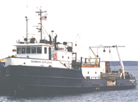
| Platform |
|
||||||||
| Itinerary |
|
||||||||
| Bounds |
|
| Organization |
384 Woods Hole Road
Quissett Campus
Woods Hole, MA02543-1598
(508) 548-8700
|
||||||||||||||
|---|---|---|---|---|---|---|---|---|---|---|---|---|---|---|---|
| Principal investigators | Marilyn ten Brink | ||||||||||||||
| Crew members |
|
||||||||||||||
| Affiliate staff | Earl Young; Bart Kreulen - Wesleyan U., watchstander; Andy Ouimette - Wesleyan U., watchstander |
| Data category: | Imagery, Location-Elevation, Sampling |
|---|---|
| Data type: | Photo, Video, Navigation, Chemistry, Geology |
| Equipment | Usage description | Data types | Datasets |
|---|---|---|---|
| DGPS | Navigation | 7 | |
| Water sampler | Chemistry | (no data reported) | |
| Video camera - deep sea | Video | (no data reported) | |
| Gravity corer | Geology | 1 | |
| 35 mm camera | Photo | (no data reported) | |
| Grab sampler | Biology, Geology | 2 |
| Dataset name | Equipment | Description | Dataset contact |
|---|---|---|---|
| 1996-024-FA-LN-001-01 | DGPS | JD170 Field Navigation (txt file) June 18, 1996 raw GPS navigation file containing 10-second fixes. | Nancy K. Soderberg |
| 1996-024-FA-LN-001-02 | DGPS | JD171 Field Navigation (txt file) June 19, 1996 raw GPS navigation file containing 10-second fixes. | Nancy K. Soderberg |
| 1996-024-FA-LN-001-03 | DGPS | JD172 Field Navigation (txt file) June 20, 1996 raw GPS navigation file containing 10-second fixes. | Nancy K. Soderberg |
| 1996-024-FA-LN-001-04 | DGPS | JD173 Field Navigation (txt file) June 21, 1996 raw GPS navigation file containing 10-second fixes. | Nancy K. Soderberg |
| 1996-024-FA-LN-001-05 | DGPS | JD174 Field Navigation (txt file) June 22, 1996 raw GPS navigation file containing 10-second fixes. | Nancy K. Soderberg |
| 1996-024-FA-LN-001-06 | DGPS | JD175 Field Navigation (txt file) June 23, 1996 raw GPS navigation file containing 10-second fixes. | Nancy K. Soderberg |
| 1996-024-FA-LN-001-07 | DGPS | JD176 Field Navigation (txt file) June 24, 1996 raw GPS navigation file containing 10-second fixes. | Nancy K. Soderberg |
| 1996-024-FA-SC-001 | Gravity corer | CORE samples | Brian Buczkowski |
| Dataset name | Equipment | Description | Dataset contact |
|---|---|---|---|
| c7tab1_LIS | Grab sampler | Summary of sample locations and mercury concentrations in samples from Long Island Sound | Lawrence J Poppe |
| lisgrabs | Grab sampler | Location of surficial samples used in the analysis of metal distributions in Long Island Sound. | Ellen Mecray |