| Identifier | 1998-015-FA | ||||||||
|---|---|---|---|---|---|---|---|---|---|
| Purpose | Multibeam bathymetry and backscatter intensity. | ||||||||
| Location | Great South Channel, Empire Knight, Massachusetts Bay, Massachusetts, Historic Area Remediation Site (HARS), Hudson Shelf Valley, New York, United States, North America, North Atlantic; | ||||||||
| Summary | Bathymetry and backscatter intensity of the sea floor collected using a Simrad EM1000 multibeam echosounder in Great South Channel, Hudson Shelf Valley, the Historic Area Remediation Site, and along the south coast of Long Island, New York | ||||||||
| Info derived | Multibeam bathymetry and backscatter intensity | ||||||||
| Comments | Cruise will be in three legs: (1) Hudson Shelf Valley; (2) southern shore of Long Island; (3) Great South Channel. | ||||||||
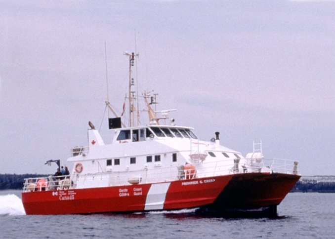
| Platform |
|
||||||||
| Itinerary |
|
||||||||
| Bounds |
|
| Organization |
384 Woods Hole Road
Quissett Campus
Woods Hole, MA02543-1598
(508) 548-8700
|
||||||||||||||
|---|---|---|---|---|---|---|---|---|---|---|---|---|---|---|---|
| Principal investigators | William C SchwabPage C ValentineBradford Butman | ||||||||||||||
| Crew members |
|
||||||||||||||
| Information specialist(s) |
|
||||||||||||||
| Affiliate staff | Larry Mayer - NOS; John Hughes-Clark - UNB |
| Data category: | Location-Elevation, Sonar |
|---|---|
| Data type: | Navigation, Multibeam |
| Equipment | Usage description | Data types | Datasets |
|---|---|---|---|
| Simrad EM 1000 | Multibeam | 57 | |
| DGPS | Navigation | 6 |
| Dataset name | Equipment | Description | Dataset contact |
|---|---|---|---|
| CAPENORTH_GEO4M_XYZ | Simrad EM 1000 | ASCII formatted file of the 4-m Bathymetry from the northern half of the Sea Floor off Eastern Cape Cod (Geographic) | Linda P McCarthy |
| CAPENORTHMOS_GEO4M_WGS84 | Simrad EM 1000 | 4-m GeoTIFF image of the northern half of the Backscatter Intensity Mosaic of the sea floor off Northeastern Cape Cod (Geographic) | Linda P McCarthy |
| CAPESOUTH_GEO4M_XYZ | Simrad EM 1000 | ASCII formatted file of the 4-m Bathymetry from the southern half of the Sea Floor off Eastern Cape Cod (Geographic) | Linda P McCarthy |
| CAPESOUTHMOS_GEO4M_WGS84 | Simrad EM 1000 | 4-m GeoTIFF image of the southern half of the Backscatter Intensity Mosaic of the sea floor off Eastern Cape Cod (Geographic) | Linda P McCarthy |
| fire_backi3m | Simrad EM 1000 | GeoTIFF image of the backscatter intensity of the sea floor offshore of Fire Island Inlet, New York, in 1998 (3-m resolution, Mercator, WGS 84) | Bradford Butman |
| fire_bath3m | Simrad EM 1000 | Grid of the sea-floor bathymetry offshore of Fire Island Inlet, New York, in 1998 (3-m resolution Esri binary grid, Mercator, WGS 84) | Bradford Butman |
| fire_srback3m | Simrad EM 1000 | GeoTIFF image of shaded-relief bathymetry, colored by backscatter intensity, of the sea floor offshore of Fire Island Inlet, New York, in 1998 (3-m resolution, Mercator, WGS 84) | Bradford Butman |
| fire_srelief3m | Simrad EM 1000 | GeoTIFF image of shaded-relief bathymetry of the sea floor offshore of Fire Island Inlet, New York, in 1998 (3-m resolution, Mercator, WGS 84) | Bradford Butman |
| HARS1998_3m_bathymetry | Simrad EM 1000 | Bathymetry of the Historic Area Remediation Site in 1998 (3-m resolution Esri binary grid and 32-bit GeoTIFF, Mercator, WGS 84) | Bradford Butman |
| Hars1998Mos | Simrad EM 1000 | GeoTIFF image of the backscatter intensity of the sea floor of the Historic Area Remediation Site in 1998 (3-m resolution, Mercator, WGS 84) | Bradford Butman |
| Hars1998Pseudo | Simrad EM 1000 | GeoTIFF image of the shaded-relief bathymetry of the sea floor, colored by backscatter intensity, of the Historic Area Remediation Site in 1998 (3-m resolution, Mercator, WGS 84) | Bradford Butman |
| Hars1998Sun | Simrad EM 1000 | GeoTIFF image of the shaded-relief bathymetry of the Historic Area Remediation Site in 1998 (3-m resolution, Mercator, WGS 84) | Bradford Butman |
| HSV_12m_backscatter | Simrad EM 1000 | GeoTIFF image of the backscatter intensity of the sea floor of the Hudson Shelf Valley (12-m resolution, Mercator, WGS 84) | Bradford Butman |
| HSV_12m_bathymetry | Simrad EM 1000 | Bathymetry of the Hudson Shelf Valley (12-m resolution Esri binary grid and 32-bit GeoTIFF, Mercator, WGS 84) | Bradford Butman |
| hsv_srback12m | Simrad EM 1000 | GeoTIFF image of shaded-relief bathymetry, colored by backscatter intensity, of the sea floor of the Hudson Shelf Valley (12-m resolution, Mercator, WGS 84) | Bradford Butman |
| hsv_srelief12m | Simrad EM 1000 | GeoTIFF image of shaded-relief bathymetry of the sea floor of the Hudson Shelf Valley (12-m resolution, Mercator, WGS 84) | Bradford Butman |
| mont_backi3m | Simrad EM 1000 | GeoTIFF image of the backscatter intensity of the sea floor southwest of Montauk Point, New York, in 1998 (3-m resolution, Mercator, WGS 84) | Bradford Butman |
| mont_bath3m | Simrad EM 1000 | Grid of the sea-floor bathymetry southwest of Montauk Point, New York, in 1998 (3-m resolution Esri binary grid, Mercator, WGS 84) | Bradford Butman |
| mont_srback3m | Simrad EM 1000 | GeoTIFF image of shaded-relief bathymetry, colored by backscatter intensity, of the sea floor southwest of Montauk Point, New York, in 1998 (3-m resolution, Mercator, WGS 84) | Bradford Butman |
| mont_srelief3m | Simrad EM 1000 | GeoTIFF image of shaded-relief bathymetry of the sea floor southwest of Montauk Point, New York, in 1998 (3-m resolution, Mercator, WGS 84) | Bradford Butman |
| morich_backi3m | Simrad EM 1000 | GeoTIFF image of the backscatter intensity of the sea floor offshore of Moriches Inlet, New York, in 1998 (3-m resolution, Mercator, WGS 84) | Bradford Butman |
| morich_bath3m | Simrad EM 1000 | Grid of the sea-floor bathymetry offshore of Moriches Inlet, New York, in 1998 (3-m resolution Esri binary grid, Mercator, WGS 84) | Bradford Butman |
| morich_srback3m | Simrad EM 1000 | GeoTIFF image of shaded-relief bathymetry, colored by backscatter intensity, of the sea floor offshore of Moriches Inlet, New York, in 1998 (3-m resolution, Mercator, WGS 84) | Bradford Butman |
| morich_srelief3m | Simrad EM 1000 | GeoTIFF image of shaded-relief bathymetry of the sea floor offshore of Moriches Inlet, New York, in 1998 (3-m resolution, Mercator, WGS 84) | Bradford Butman |
| shin_backi3m | Simrad EM 1000 | GeoTIFF image of the backscatter intensity of the sea floor offshore of Shinnecock Inlet, New York, in 1998 (3-m resolution, Mercator, WGS 84) | Bradford Butman |
| shin_bath3m | Simrad EM 1000 | Grid of the sea-floor bathymetry offshore of Shinnecock Inlet, New York, in 1998 (3-m resolution Esri binary grid, Mercator, WGS 84) | Bradford Butman |
| shin_srback3m | Simrad EM 1000 | GeoTIFF image of shaded-relief bathymetry, colored by backscatter intensity, of the sea floor offshore of Shinnecock Inlet, New York, in 1998 (3-m resolution, Mercator, WGS 84) | Bradford Butman |
| shin_srelief3m | Simrad EM 1000 | GeoTIFF image of shaded-relief bathymetry of the sea floor offshore of Shinnecock Inlet, New York, in 1998 (3-m resolution, Mercator, WGS 84) | Bradford Butman |
| fire_nav | DGPS | Tracklines of a multibeam survey of the sea floor offshore of Fire Island Inlet, New York, in 1998 (polyline shapefile, geographic, WGS 84) | Bradford Butman |
| Hars1998Nav | DGPS | Tracklines of a multibeam survey of the sea floor in the Historic Area Remediation Site in 1998 (polyline shapefile, geographic, WGS 84) | Bradford Butman |
| hsv_1998_nav | DGPS | Tracklines of a multibeam survey of the Hudson Shelf Valley carried out in 1998 (polyline shapefile, geographic, WGS 84) | Bradford Butman |
| mont_nav | DGPS | Tracklines of a multibeam survey of the sea floor southwest of Montauk Point, New York, in 1998 (polyline shapefile, geographic, WGS 84) | Bradford Butman |
| morich_nav | DGPS | Tracklines of a multibeam survey of the sea floor offshore of Moriches Inlet, New York, in 1998 (polyline shapefile, geographic, WGS 84) | Bradford Butman |
| shin_nav | DGPS | Tracklines of a multibeam survey of the sea floor offshore of Shinnecock Inlet, New York, in 1998 (polyline shapefile, geographic, WGS 84) | Bradford Butman |
| Dataset name | Equipment | Description | Dataset contact |
|---|---|---|---|
| q1_1mctr | Simrad EM 1000 | 1-m interval contours of smoothed multibeam bathymetry in western Massachusetts Bay map Quadrangle 1 | Bradford Butman |
| q1_5mctr | Simrad EM 1000 | 5-m interval contours of smoothed multibeam bathymetry in western Massachusetts Bay map Quadrangle 1 | Bradford Butman |
| q1_backgs | Simrad EM 1000 | 6-m resolution gray-scale image of multibeam backscatter intensity in western Massachusetts Bay map Quadrangle 1 | Bradford Butman |
| q1_backpc | Simrad EM 1000 | 6-m resolution image of shaded relief multibeam bathymetry in western Massachusetts Bay map Quadrangle 1, pseudo-colored by backscatter intensity | Bradford Butman |
| q1_bathy6m | Simrad EM 1000 | 6-m resolution grid of multibeam bathymetry in western Massachusetts Bay map Quadrangle 1 | Bradford Butman |
| q1_srelief | Simrad EM 1000 | 6-m resolution gray-scale image of shaded-relief multibeam bathymetry in western Massachusetts Bay map Quadrangle 1 | Bradford Butman |
| q2_1mctr | Simrad EM 1000 | 1-m interval contours of smoothed multibeam bathymetry in western Massachusetts Bay map Quadrangle 2 | Bradford Butman |
| q2_5mctr | Simrad EM 1000 | 5-m interval contours of smoothed multibeam bathymetry in western Massachusetts Bay map Quadrangle 2 | Bradford Butman |
| q2_backgs | Simrad EM 1000 | 6-m resolution gray-scale image of multibeam backscatter intensity in western Massachusetts Bay map Quadrangle 2 | Bradford Butman |
| q2_backpc | Simrad EM 1000 | 6-m resolution image of shaded relief multibeam bathymetry in western Massachusetts Bay map Quadrangle 2, pseudo-colored by backscatter intensity | Bradford Butman |
| q2_bathy6m | Simrad EM 1000 | 6-m resolution grid of multibeam bathymetry in western Massachusetts Bay map Quadrangle 2 | Bradford Butman |
| q2_srelief | Simrad EM 1000 | 6-m resolution gray-scale image of shaded-relief multibeam bathymetry in western Massachusetts Bay map Quadrangle 2 | Bradford Butman |
| q3_1mctr | Simrad EM 1000 | 1-m interval contours of smoothed multibeam bathymetry in western Massachusetts Bay map Quadrangle 3 | Bradford Butman |
| q3_5mctr | Simrad EM 1000 | 5-m interval contours of smoothed multibeam bathymetry in western Massachusetts Bay map Quadrangle 3 | Bradford Butman |
| q3_backgs | Simrad EM 1000 | 6-m resolution gray-scale image of multibeam backscatter intensity in western Massachusetts Bay map Quadrangle 3 | Bradford Butman |
| q3_backpc | Simrad EM 1000 | 6-m resolution image of shaded relief multibeam bathymetry in western Massachusetts Bay map Quadrangle 3, pseudo-colored by backscatter intensity | Bradford Butman |
| q3_bathy6m | Simrad EM 1000 | 6-m resolution grid of multibeam bathymetry in western Massachusetts Bay map Quadrangle 3 | Bradford Butman |
| q3_srelief | Simrad EM 1000 | 6-m resolution gray-scale image of shaded-relief multibeam bathymetry in western Massachusetts Bay map Quadrangle 3 | Bradford Butman |
| wmb_1mctr | Simrad EM 1000 | 1-m interval contours of smoothed multibeam bathymetry in western Massachusetts Bay map Quadrangles 1-3 | Bradford Butman |
| wmb_5mctr | Simrad EM 1000 | 5-m interval contours of smoothed multibeam bathymetry in western Massachusetts Bay map Quadrangles 1-3 | Bradford Butman |
| wmb_bathy6m | Simrad EM 1000 | 6-m resolution grid of multibeam bathymetry of western Massachusetts Bay map Quadrangles 1-3 | Bradford Butman |
| mb_5mctr9x9 | Simrad EM 1000 | 5-m interval contours of smoothed multibeam bathymetry of Massachusetts Bay. The series report also provides an unsmoothed version of the 5-m contours. | Brad Butman |
| mb_10mctr9x9 | Simrad EM 1000 | 10-m interval contours of smoothed multibeam bathymetry of Massachusetts Bay. The series report also provides an unsmoothed version of the 10-m contours. | Brad Butman |
| mb_backgs10m | Simrad EM 1000 | 10-m resolution gray-scale image of multibeam backscatter intensity in Massachusetts Bay. Also available from the series report in 20m and 30m resolutions. | Bradford Butman |
| mb_backpc10m | Simrad EM 1000 | 10-m resolution image of shaded relief multibeam bathymetry in Massachusetts Bay, pseudocolored by backscatter intensity. Also available from the series report in 20-m and 30-m resolutions. | Bradford Butman |
| mb_bathygs10m | Simrad EM 1000 | 10-m resolution gray-scale image of multibeam bathymetry in Massachusetts Bay. Also available from the series report in 20-m and 30-m resolutions. | Bradford Butman |
| mb_srelief10m | Simrad EM 1000 | 10-m resolution image of shaded relief multibeam bathymetry in Massachusetts Bay. Also available from the series report in 20m and 30m resolutions. | Bradford Butman |
| mb_bathyclr10m | Simrad EM 1000 | 10-m resolution image of shaded relief multibeam bathymetry in Massachusetts Bay, colored by water depth. Also available from the series report in 20-m and 30-m resolutions. | Bradford Butman |
| mb_bathy10m | Simrad EM 1000 | 10-m resolution grid of multibeam bathymetry in Massachusetts Bay. Also available from the series report in 20m and 30m resolutions. | Bradford Butman |
| Dataset name | Description | Dataset contact |
|---|---|---|
| CapeCodBay_10m | Cape Cod Bay: continuous bathymetry and topography terrain model of the Massachusetts coastal zone and continental shelf, (32-bit GeoTIFF, UTM 19 NAD 83, NAVD 88 vertical datum) | Brian Andrews |
| CapeCodBay_Source | Cape Cod Bay: Polygon boundaries for source data of a continuous bathymetry and topography terrain model of the Massachusetts coastal zone and continental shelf: (Esri polygon shapefile, Geographic, NAD 83) | Brian Andrews |
| MassBay_10m | Massachusetts Bay and adjacent land: continuous bathymetry and topography terrain model of the Massachusetts coastal zone and continental shelf, (32-bit GeoTIFF, UTM 19 NAD 83, NAVD 88 vertical datum) (version2) | Brian Andrews |
| MassBay_Source | Massachusetts Bay and adjacent land: Polygon boundaries for source data of a continuous bathymetry and topography terrain model of the Massachusetts coastal zone and continental shelf: (Esri polygon shapefile, Geographic, NAD 83) | Brian Andrews |
| Ntkt_VS_10m | Vineyard and Nantucket Sounds, southern coast of Cape Cod including Martha's Vineyard and Nantucket: continuous bathymetry and topography terrain model of the Massachusetts coastal zone and continental shelf, (32-bit GeoTIFF, UTM 19 NAD 83, NAVD 88 vertical datum) | Brian Andrews |
| Ntkt_VS_Source | Vineyard and Nantucket Sounds, Southern coast of Cape Cod including Martha's Vineyard and Nantucket: Polygon boundaries for source data of a continuous bathymetry and topography terrain model of the Massachusetts coastal zone and continental shelf: (Esri polygon shapefile, Geographic, NAD 83) | Brian Andrews |