| Identifier | 1999-026-FA | ||||||||
|---|---|---|---|---|---|---|---|---|---|
| Alternate names | MD 99-02; IMAGES V, Leg 1 | ||||||||
| Purpose | Conduct an interdisciplinary study of Holocene paleoclimate and ecosystem history, methanogenesis, and geological evolution of modern Chesapeake Bay. To accomplish these goals, collect long piston cores (>20 meters) from the mesohaline portion of Chesapeake Bay. | ||||||||
| Location | Chesapeake Bay, United States, North America, North Atlantic; | ||||||||
| Summary | Coring exercises collected 6 cores at 5 sites (approx. 68 m of sediments); digital core photos; spectrophotometry; pore water samples; radiocarbon samples; and MST logging (magnetics, gamma and p-wave). | ||||||||
| Comments | WHSC personnel John Bratton and Pattie Baucom were on the entire leg of this cruise; Steve Colman was shipboard from near Norfolk, VA to Delaware. Other USGS participants were not with WHSC. Original Center People field contained: John Bratton, sediment and porewater geochemistry; Steve Colman, project management; Pattie Baucom, core description, sampling, sedimentology; Mob./transport: TBA. | ||||||||
| URL | |||||||||
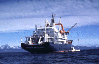
| Platform |
|
||||||||
| Itinerary |
|
||||||||
| Bounds |
|
| Organization |
384 Woods Hole Road
Quissett Campus
Woods Hole, MA02543-1598
(508) 548-8700
|
||||||
|---|---|---|---|---|---|---|---|
| Principal investigators | John F BrattonStephen Colman | ||||||
| Crew members |
|
||||||
| Affiliate principal | Tom Cronin - USGS, Reston; Peter Vogt - Naval Research Lab; Jeff Halka - MD GS | ||||||
| Affiliate staff | Yvon Balut - ship operations chief; Elisabeth Michel - co-chief scientist, Leg 1; USGS: T. Cronin (06/20 - 06/29), D. Willard (06/20 - 06/21 only), L. Weimer (06/20 - 06/21 only), S. Colman, J. Bratton (06/20 - 06/29), P. Baucom (06/20 - 06/29), T. Sheehan (06/20 - 06/29), R. Wagner (06/20 - 06/29); Naval Research Lab: P. Vogt (06/20 - 06/21 only), R. Coffin, J. Pohlman (06/20 - 06/21 only); Maryland Geol. Survey: J. Hill (06/20 - 06/21 only), J. Halka, C. Williams; U. So. Illinois: S. Ishman (06/20 - 06/29); U. Rhode Island: J. King; Queens College: Y. Zhang; Duke Univ.: G. Dwyer; U. So. Carolina: J. Friddell (06/20 - 06/29); other IMAGES co-chief scientists and ship crew. |
| Data category: | Location-Elevation, Sampling |
|---|---|
| Data type: | Navigation, Chemistry, Geology |
| Equipment | Usage description | Data types | Datasets |
|---|---|---|---|
| Calypso corer | Geology | 1 | |
| GPS (wh) | Navigation | 1 | |
| Water sampler | Chemistry | (no data reported) |
| Dataset name | Equipment | Description | Dataset contact |
|---|---|---|---|
| 1999-026-FA-SC-001-01 | Calypso corer | Core samples analyses: including grain size, radiocarbon, palynology, trace metals, water content, and other geochemistry analyses. | John F Bratton |
| 1999-026-FA-LN-001 | GPS (wh) | Daily ship tracks: 9 page-size track maps of varying scales; contain date, latitude, longitude, hourly time ticks, some 15-minute and 5-minute ticks, and core site numbers (007, 008, 009, 10. | Nancy K. Soderberg |