| Identifier |
2002-047-FA |
| Purpose |
Map shallow geologic framework of L'Hommedieu Shoal. |
| Location |
L'Hommedieu Shoals, Vineyard Sound, Nantucket Sound, Massachusetts, United States, North America, North Atlantic; |
| Summary |
This was a demonstration cruise of WHFC sea floor mapping capability. |
| Comments |
This was a demonstration of sea floor mapping capability and application to resource/environmental issues for OMB examiner. |
| Platform |
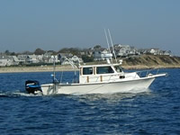
| Rafael 25 feet
|
 |
|
| Itinerary |
| Start |
Woods Hole, MA |
2002-06-05 |
| End |
Woods Hole, MA |
2002-06-07 |
| Days in the field |
2 |
|
| Bounds |
| West |
-70.5 |
| East |
-70 |
| North |
41.55 |
| South |
41.4 |
|