| Identifier | 2004-015-FA | ||||||||
|---|---|---|---|---|---|---|---|---|---|
| Purpose | Carry out multibeam survey (bathymetry and backscatter intensity) of an area offshore of Massachusetts in the southern Merrimack Embayment in the western Gulf of Maine. The survey will be carried out under contract by the University of New Hampshire. | ||||||||
| Location | southern Merrimack Embayment, western Gulf of Maine, Massachusetts, United States, North America, North Atlantic; | ||||||||
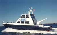
| Summary | Science Application International Corporation (SAIC) was contracted through UNH to conduct a multibeam survey on their survey vessel, the R/V OCEAN EXPLORER (leased from Northeast Marine Services). | ||||||||
| Info derived | Sea floor map; Bathymetric maps; Morphology; | ||||||||
| Comments | This cruise was carried out under contract to the University of New Hampshire; UNH and their subcontractor (SAIC) are responsible for all cruise logistics, data collection, processing and gridding. OCEAN EXPLORER will survey in 2-3 day legs, weather dependent; USGS personnel may participate in selected legs but will not participate in the entire cruise. USGS personnel will monitor data quality delivered after each leg. Cruise dates will depend on UNH contractor schedule, weather, and transfer of funds from the USGS to UNH. Original Center People field contained: William Danforth (data quality and archive), Brian Andrews (data quality and archive), Brad Butman (science and contracting). Original Submitted By field contained: Brad Butman and Brian Andrews. Project = Southern Merrimack Embayment Multibeam Survey, Southern Merrimack Embayment Multibeam Survey Information from Foghorn: Reson 8101 24 kHz; TSS POS/MV; Brooke Ocean Technology MVP30; SAIC will carry out this work using the R/V Ocean Explorer under subcontract to the University of New Hampshire (UNH). | ||||||||
| URL | |||||||||
| Platform |
|
||||||||
| Itinerary |
|
||||||||
| Bounds |
|
| Organization |
384 Woods Hole Road
Quissett Campus
Woods Hole, MA02543-1598
(508) 548-8700
|
||||||
|---|---|---|---|---|---|---|---|
| Principal investigators | Bradford Butman | ||||||
| Crew members |
|
||||||
| Information specialist(s) |
|
||||||
| Affiliate principal | Larry Mayer, University of New Hampshire; Susan Snow-Cotter, MA CZM | ||||||
| Affiliate staff | Larry Mayer, University of New Hampshire |
| Data category: | Sonar, Location-Elevation |
|---|---|
| Data type: | Sound Velocity, Navigation, Multibeam |
| Equipment | Usage description | Data types | Datasets |
|---|---|---|---|
| Reson 8101 | Multibeam | 2 | |
| Sensor - MVP30 (Odim) | Sound Velocity | 1 | |
| DGPS | Navigation | (no data reported) |
| Dataset name | Equipment | Description | Dataset contact |
|---|---|---|---|
| 2004-015-FA-SO-001 | Reson 8101 | DVD ROM disk of FINALREPORT RAW BEAM 048/6-10, RAW MBEAM 049/1-17, 054/1-8, PROC SSS 054/3-6, 055/2-13, PROC SSS 055/14-18, 056/1-13, PROC SSS 056/14-31, 057/1-10, PROC SSS 057/12-13, 058/1-17, PROC SSS 058/18-22,*, PROC SSS 059/17-20, 060/2-12, PROC SSS 060/13,15-20,*, PROC SSS 061/11-22,074/3-20*, PROC SSS 075/21-38,41-52,*, PROC SSS 076/11-28,*, | Nancy K. Soderberg |
| Bathymetry GIS data | Reson 8101 | Linda P McCarthy | |
| 2004-015-FA-BA-001 | Sensor - MVP30 (Odim) | DVD ROM disk of FINALREPORT RAW BEAM 048/6-10, RAW MBEAM 049/1-17, 054/1-8, PROC SSS 054/3-6, 055/2-13, PROC SSS 055/14-18, 056/1-13, PROC SSS 056/14-31, 057/1-10, PROC SSS 057/12-13, 058/1-17, PROC SSS 058/18-22,*, PROC SSS 059/17-20, 060/2-12, PROC SSS 060/13,15-20,*, PROC SSS 061/11-22,074/3-20*, PROC SSS 075/21-38,41-52,*, PROC SSS 076/11-28,*, | Nancy K. Soderberg |