Electrical resistivity surveying, submarine groundwater sampling with piezometers, and groundwater discharge measurements in the Corsica River Estuary.
Location
Chesapeake Bay, United States, North America, North Atlantic;
Summary
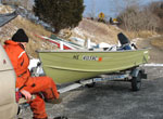
The estuary of Maryland's Corsica River, a small tributary on the eastern shore of Chesapeake Bay, was the site of fieldwork during April and May 2007. An interdisciplinary team of U.S. Geological Survey (USGS) scientists investigated submarine groundwater discharge: the movement of ground water into the coastal ocean via underwater seepage. Resource managers are concerned about nutrients entering the estuary through this pathway, leading to eutrophication, harmful algal blooms, and fish kills. The Corsica River watershed has been targeted by the State of Maryland for implementation of intensive restoration efforts to improve water quality. The scientists sought to test hypotheses about groundwater flow under the estuary and groundwater discharge into the estuary and to constrain the results of ongoing modeling efforts by colleagues from the USGS Water Resources Discipline, including Ward Sanford. The team used a continuous resistivity-profiling system (a method for detecting low-salinity submarine ground water over a large area), offshore piezometers (temporary wells used to collect groundwater samples from discrete depths), seepage meters (devices for measuring direct groundwater discharge at a particular location on the sediment surface), and a raft equipped with instrumentation to measure radon-222 (a natural tracer of groundwater discharge). This work expands on a previous investigation in the lower Potomac River estuary in September 2006, which characterized similar processes in that geologically distinct and much larger, western-shore tributary of Chesapeake Bay. Results of sampling and geophysical measurements indicate that the Corsica River estuary is underlain by fresh ground water in sediment pores at depths of less than 1 m to more than 5 m below the sediment surface, depending on distance from shore and the presence of confining units. In some locations, low-salinity ground water may extend more than 200 m offshore, as evidenced by electrical-resistivity data. Brackish ground water that was more saline than surface water was encountered at shallow subsurface depths at sites more than 8 m from shore, indicating submarine recharge during a previous period when surface-water salinity was higher. Samples of ground water and surface water were collected for analysis of nutrients, stable isotopes, radioisotopes, and age tracers, among other parameters. Groundwater discharge and submarine recharge at the site were highly dynamic, as evidenced by changes in the salinity of groundwater samples collected at the same locations on different days, large variations in seepage-meter measurements, and fluctuations by a factor of three or more in surface-water radon activities during the measurement period. John Bratton, John Crusius, and Kevin Kroeger of the USGS Woods Hole Science Center (WHSC) in Woods Hole, Massachusetts, conducted the work, with assistance from other WHSC personnel, including VeeAnn Cross, Chuck Worley, Laura Erban, Adrian Green, and Sandy Baldwin. Collaborators included Jennifer Bowen, who recently completed a term as a Postdoctoral Scientist at the Woods Hole Marine Biological Laboratory. Bowen performed microbial sampling in the field and prepared samples in the laboratory of Jeff Cornwell at the University of Maryland Center for Environmental Science Horn Point Laboratory. Bob Shedlock (USGS Maryland-Delaware-District of Columbia Water Science Center) provided helpful input during the design stage of the field effort. The work was supported financially by the USGS Coastal and Marine Geology Program (John Haines, Program Coordinator), the USGS Priority Ecosystems Science Program (Scott Phillips, Chesapeake Bay Ecosystem Coordinator), and the Maryland Department of Natural Resources (John McCoy, Ecosystems Restoration Division Chief). The field effort benefitted significantly from the logistical support and hospitality of the Queen Anne's County Department of Parks and Recreation (Gary Rzepecki, Parks Superintendent) and the Corsica River Yacht Club (Reed Rogers, Commodore).
Comments
Initial results presented at ERF meeting in Providence, RI in 2007; USGS Chesapeake Bay meeting Baltimore, MD, Dec. 2007; and Ocean Sciences meeting in Orlando, FL, 2008. Original Center People field contained: John Bratton, USGS-Woods Hole, co-chief, electrical resistivity, piezos; John Crusius, USGS-Woods Hole, co-chief, radioisotopes and groundwater sampling; Kevin Kroeger, USGS-Woods Hole, co-chief, nutrient and dissolved gas sampling; Laura Erban, USGS-Woods Hole, piezometer sampling, radioisotope measurements; Sandy Baldwin, USGS-Woods Hole, piezometer sampling; Adrian Green, USGS-Woods Hole, piezometer sampling; Chuck Worley, USGS-Woods Hole, electrical resistivity; VeeAnn Cross, USGS-Woods Hole, resistivity data processing and navigation.
Project = Coastal Groundwater Systems--Task 5, Coastal Groundwater Systems--Task 5