Sea floor mapping along the offshore side of the southern part of the Chandeleur Islands, Gulf of America (Gulf of Mexico).
Location
Chandeleur Islands, Breton Sound, Louisiana, northern Gulf of America (Gulf of Mexico), United States, North America, North Atlantic;
Summary
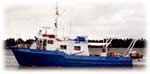
This two-week cruise aboard the R/V ACADIANA collected bathymetric, sidescan sonar and chirp seismic data along the offshore side of the southern half of the Chandeleur Island chain of eastern Louisiana. The survey was coordinated with additional surveys conducted by the R/V GILBERT and a University of New Orleans vessel that collected bathymetric and seismic data near the islands and along the back side of the island chain. The purposes for collecting these data were (1) to provide a detailed post-Katrina bathymetry, (2) to study the processes that have shaped the sea floor in an effort to better understand the effects of Hurricane Katrina, and (3) to understand the influence of the underlying stratigraphy on the sea floor geology. The offshore geophysical dataset was collected on a grid of lines spaced 100 m apart in the shore parallel direction and 1000 m apart in the shore normal direction. Submetrix swath bathymetric data and Klein sidescan sonar imagery were collected along 2146 km of tracks and EdgeTech 512i chirp sub-bottom data were collected along 1654 km of tracks.
Comments
Original Center People field contained: Electronics technicians - Chuck Worley and Emile Bergeron; sea floor mapping processors - Bill Danforth and Wayne Baldwin.
Project = Northern Gulf Coast Ecosystem Change, Northern Gulf Coast Ecosystem Change