Field Activity 2008-022-FA

Identifier 2008-022-FA
Alternate names NMFS HB0805, Leg 3; B-22-08-GK
Purpose 
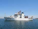
Multibeam mapping and AUV surveys of northern Georges Bank in support of testing the capability of the new MIT AUV to detect Didemnum on gravel habitats using photography and testing the BIGELOW's ME70 swath bathymetric system.
Location Georges Bank, United States, North America, North Atlantic,
Summary Cruise purpose was to test the capability of the new MIT AUV to detect the invasive tunicate Didemnum on gravel habitats using photography. Photos collected are curated at MIT Sea Grant, Boston, MA. Other purpose was to test the ME70 swath bathymetric system on the Bigelow. Total of 110 sq. km of sea bed mapped in study area. ME70 imagery curated at NOAA NMFS, Sandy Hook, NJ.
Info derived Habitat maps;
Comments There will be a port call midway in the cruise to exchange personnel, probably at Coast Guard base in Boston. Project = Benthic Habitats: Geological and Biological Studies, Benthic Habitats: Geological and Biological Studies
Platform
Henry B Bigelow
Length 209 feet; beam 49.2 feet; draft 19.4 feet.
Itinerary
Start Newport Naval Base, RI 2008-07-12
End Newport Naval Base, RI 2008-07-21
Days in the field 10
Bounds
West -67.36667
East -67.1667
North 42.16667
South 41.91667

Personnel

Organization
384 Woods Hole Road
Quissett Campus
Woods Hole, MA02543-1598
(508) 548-8700
Principal investigators Page C Valentine
Crew members
Page C Valentine
Scientist, Staff
Information specialist(s)
Page C Valentine
Specialist, Information
Affiliate principal Elisabeth Broughton, NMFS
Affiliate staff Betsy Broughton, NMFS; Judith Pederson, MIT; Jim Morash and others from MIT

Data types and categories

Data category: Imagery, Location-Elevation, Sonar
Data type: Photo, Video, Navigation, Multibeam

Equipment used

Equipment Usage description Data types Datasets
Simrad ME70 Water column reflectivity, Multibeam 1
ROV Photo, Video, Biology, Geology (no data reported)
Digital camera Photo 1
GPS (wh) Navigation (no data reported)

Datasets

Datasets produced in this activity

Dataset name Equipment Description Dataset contact
2008-022-FA-BA-001 Simrad ME70 ME70 multibeam swath bathymetric imagery. PARTNER
2008-022-FA-PH-002 Digital camera Deck photos of the AUV, its deployment, crew, scientists, etc. PARTNER

Publications

Samples collected during this field activity