Sediment thickness mapping using multichannel seismics and sonobuoys on the potential U.S. extended continental shelf north of Alaska.
Description
United States Geological Survey, Woods Hole, Massachusetts. Chief Scientists: Debbie Hutchinson, David Mosher, Geological Survey of Canada. Data of field activity 09007 (L-7-09-AR) in Arctic Ocean from 08/06/2009 to 09/16/2009
Location
Arctic Ocean
Summary
4062 km of 16-channel multichannel seismic data
51 sonobuoys (46 good)
8355 line km 12 kHz echo sounder
177 Helicopter spot soundings
9 CTD Rosettes
72 XCTDs
Underway measurement of seawater salinity, temperature, flourescence, gas tension, and oxygen saturation.
Underway ice observations (log)
Underway marine mammal observations (log)
Info derived
Notes/logs;Seismic;Other geophysical
Comments
Cruise dates may vary. This is planned as a two-icebreaker experiment (with USCGC Healy). This is planned as a two-icebreaker experiment (with USCGC Healy). 18. Report Date: 11:35 8/3/2009
Staff information imported from InfoBank
Deborah Hutchinson - Chief Scientist
David Mosher (Chief Scientist) - Geological Survey of Canada
John Shimeld (lead seismic analyst, ) - GSC
Borden Chapman - lead seismic operations
Non USGS data manager = Debbie Hutchinson
Information from Foghorn: Multichannel seismic system; Sonobuoys; Calibrated hydrophone; XCTD, SVP (velocity of water); 12 kHz single beam echo sounder
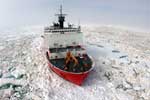
Platform
Louis S St Laurent
392 feet
Healy
Length 420 feet; beam 82 feet; draft 29 feet.
Itinerary
Start
Kugluktuk, Nunavut, Canada and Kugluktuk, Nunavut, Canada
2009-08-06
End
Kugluktuk, Nunavut, Canada and Kugluktuk, Nunavut, Canada